
ClimateWatch: AUGUST outlook & El Niño update
3/08/2026 2:07pm
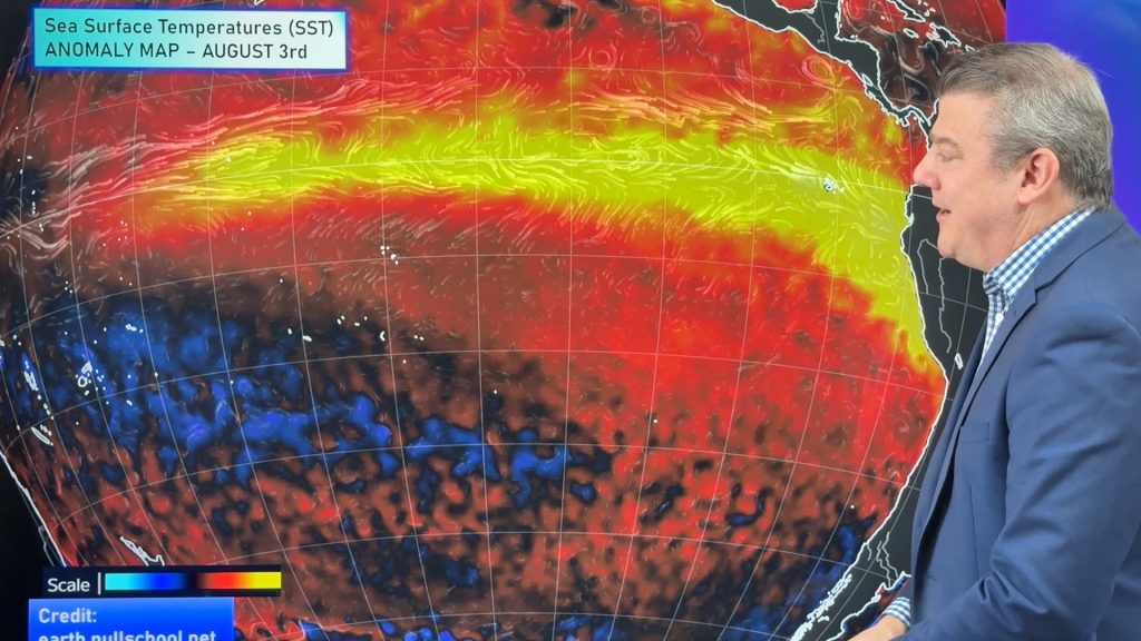
El Niño continues to intensify and will do so right through to the end of our spring in NZ and Australia. For now it hasn’t disrupted our weather too much, although it is harder to measure it in winter in our part of the world due to the usual chaotic wintry weather from south of our nations. With El Niño we’ll be looking for more high pressure stuck in the Tasman Sea going into spring as historically El Niño has done this, bringing dry weather to Australia and more westerlies into NZ during our spring and summer months – and that can reduce rainfall inland and to the east of both countries.
We are seeing an uptick in high pressure which may be more noticeable this month, but still enough variety to bring in occasional wet weather to most, but not all, regions.
For large parts of Australia dry weather looks to increase over the coming few weeks, while in New Zealand it’s a messier pattern with more showers.
This video takes a look at how El Niño is progressing, what is happening over the Southern Ocean and Indian Ocean and upcoming rainfall and air pressure for NZ, Australia and the south-west Pacific.
ClimateWatch is mostly a focus on air pressure, upcoming rainfall and wind for Australia and NZ and a big picture view of what is currently driving our climate.
Latest Video
Cold front, low pressure, then windy westerlies kick back in
A cold front is today and tomorrow moving into the country, with coldest weather in the southern half of the…
Related Articles
Cold front, low pressure, then windy westerlies kick back in
A cold front is today and tomorrow moving into the country, with coldest weather in the southern half of the…
Cold change coming, northern low too
Temperatures will lift today and tonight ahead of a cold southern change tomorrow and Thursday, which will affect the southern…
Next spring blast coming, we track the gales & rain
Many places will become warmer over the next few days, ahead of a cold change mid to late week. Windy…

