Australia: Finally, some rain for the bushfires and drought regions (+6 Maps)
15/01/2020 6:44pm

> From the WeatherWatch archives
Rain clouds are building around the Australian bushfires and drought zones for Thursday, Friday and possibly the weekend too.
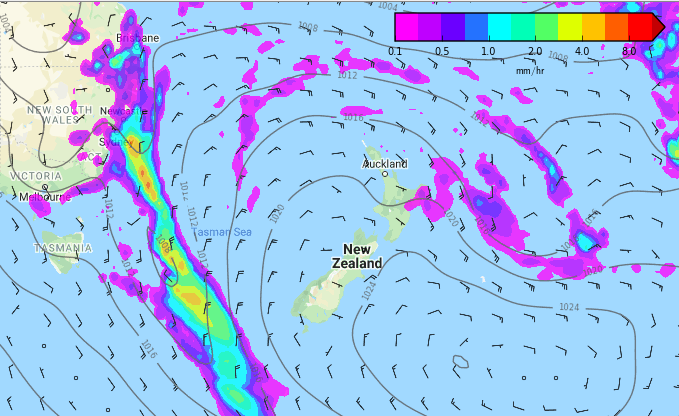
As high pressure dominates New Zealand bringing mainly dry weather there, the same high is bringing a humid north to north east flow into eastern Australia. It’s this humid air flow which is likely to generate downpours then more widespread rain for a time.
It looks to be best chance of rain in a number of months for the area but this set up doesn’t bring significant relief to all affected areas, some may only have a few showers or drizzle patches which won’t amount to a lot. Others may get 50mm+ in more localised areas.


RAIN ACCUMULATION MAPS (From 1pm Weds 15th to this Sunday Night)
GFS (American modelling)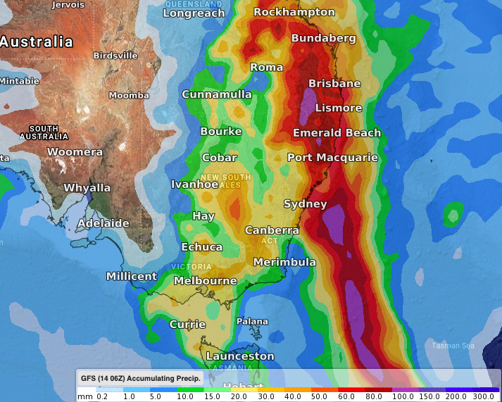
ECMWF (European modelling)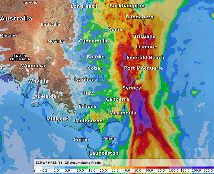
IBM modelling (7 days)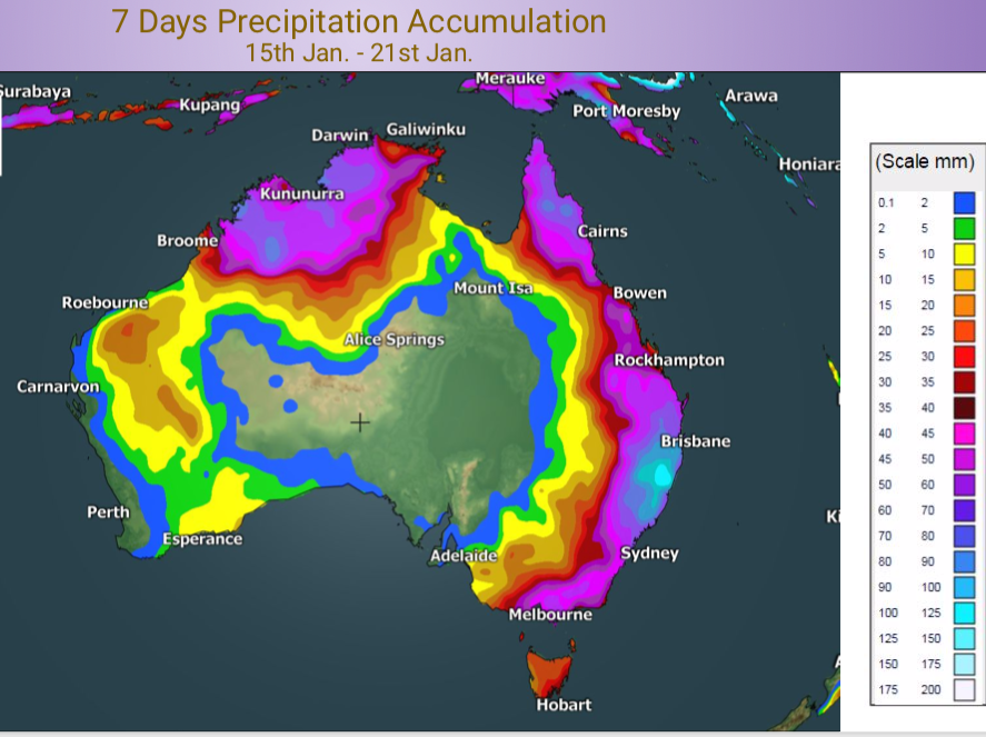
– WeatherWatch.co.nz
Comments
Latest Video

Cold weekend, frosts return with high pressure, then a low late next week
The subantarctic airflow spreads over NZ today/tonight and into Saturday, dropping temperatures nationwide. Snow flurries are possible today to lower…
Related Articles

Meteors – Your Eyewitness Reports!
WeatherWatch.co.nz receives meteor reports from all over New Zealand and the globe, 24/7/365. **CASUAL COMMENTS**If you’ve seen something in the…

Snow, rain showers & cold polar southerlies set to return
Friday will be a wintry day across NZ as the next cold front arrives, bringing snow to lower levels of…

Polar airflows set to bring cold weekend to NZ
Nor-west winds will be building over parts of NZ going into Thursday with rain on the West Coast becoming heavy…


Guest on 15/01/2020 3:07am
what a bout here we had the driest year in 12 years last year with the driest spring and autmn in that time too…
Guest on 15/01/2020 11:56pm
Not at all in Auckland,been wet right to the end of October and had a few days here and there of showers.