Wednesday’s weather headlines (x3): Front moves northwards, Fog risk, Rain end of the month?
15/02/2022 6:00pm

> From the WeatherWatch archives
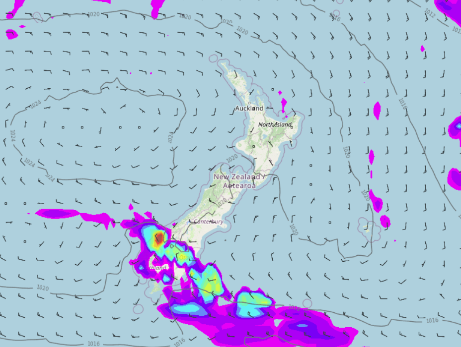
WEAKENING FRONT PUSHES NORTHWARDS
A weakening cold front moves northwards over the South Island today. Rain about Southland, Otago and Fiordland clears this morning then as the front moves into Canterbury it is likely to only bring a few showers, clearing this evening.
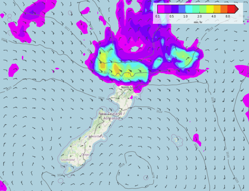
MORNING FOG POTENTIAL
There may be a few morning fog patches about the inner North Island this morning then tomorrow morning both Islands may see areas of fog for inland parts. To check your location for fog potential visit ruralweather.co.nz, type in your town or city into the search box, click on the “Fog/Cloud” tab then check the graph for the fog risk.
The graph below here is for Hamilton. This morning and Thursday morning show a chance of fog.
RAIN IN THE NORTH TOWARDS THE END OF THE MONTH?
Some regions around New Zealand have had their fair share of rain recently, especially the upper South Island and lower North Island but some areas at either end of the country are still a bit dry. Long range models hint at some rain potential towards the end of February in the far north. This isn’t locked in yet as it is quite a while away but just a heads up about possibilities further out.
Latest Video

Slow go for northern low & southern cold
For the next few days low pressure will crawl over the upper North Island, driving in rain as far south…
Related Articles
Slow go for northern low & southern cold
For the next few days low pressure will crawl over the upper North Island, driving in rain as far south…

Slow moving low to track over northern NZ
A low pressure zone will slowly cross the North Island over the coming days, bringing hit and miss pockets of…

NI low pressure, SI polar change
Low pressure will move over the upper North Island this week, bringing hit and miss pockets of heavier rain into…

