Weather headlines (x3) for Wednesday: Low moves past – North Island, Frosty this morning – South Island, Cold front Thursday
28/06/2022 7:00pm
> From the WeatherWatch archives
Here’s what is making the weather headlines today.
LOW MOVES PAST THE NORTH ISLAND
A low passes by the northeast of the North Island today, gradually moving away to the southeast. This low brings a chance of heavy rain this morning for eastern Northland, this afternoon for Coromandel then this evening for northern East Cape. There is a chance if the low tracks a little further offshore that heavy rain may stay offshore too.
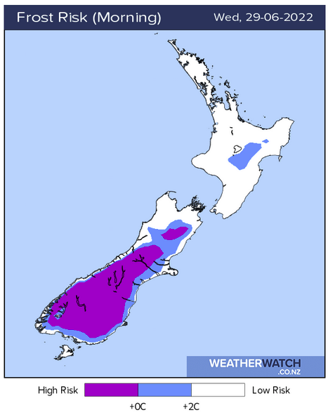
FROSTY THIS MORNING FOR THE SOUTH ISLAND
There is a period of calm this morning for the South Island with frosts likely, especially inland.
COLD FRONT MOVES NORTHWARDS ON THURSDAY
A cold front moves onto the lower South Island around midday on Thursday, reaching Canterbury in the evening bringing a period of rain then easing to showers. As rain eases to showers snow may lower to about 400m. Areas of precipitation clear overnight north of about Otago Peninsula through to Canterbury.
This cold front reaches the North Island on Friday but it will have weakened, a few snow flurries may develop to about 800 or maybe 700m at a push for the Central Plateau and the eastern ranges for a time.
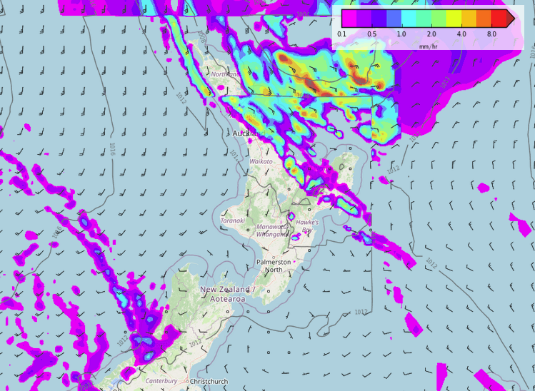
MSLP / Rain map – Thursday Midday 
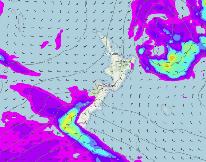
MSLP / Rain map – Friday 9:00am
Latest Video

Temperature changes for some regions ahead of heavy West Coast rain
A nor-wester is about to kick in and it’s coming from out of Australia, boosting temperatures in some regions going…
Related Articles
Temperature changes for some regions ahead of heavy West Coast rain
A nor-wester is about to kick in and it’s coming from out of Australia, boosting temperatures in some regions going…

NZ 7 day forecast: Showers, temp changes and heavy West Coast rain
NZ has a fairly messy forecast over the next 7 days, but the main feature will be heavy rain on…

Cold fronts continue, wind & rain for some Fri/Sat
Wet weather is moving over the North Island today, while the South Island has drier skies – ahead of another…

