Weather headlines (x3) for Wednesday: Few showers in the east today, Temperatures today and this weekend
26/04/2022 7:00pm

> From the WeatherWatch archives
Here’s what is making the weather headlines today.
A FEW SHOWERS IN THE EAST, DRIER OUT WEST
A southerly quarter airflow over New Zealand today brings cloud and a few showers in the east, conditions are drier and and generally sunnier out west. The western and upper North Island does see some cloud at times. This evening or overnight a few showers move into Coromandel then eastern Northland with easterly winds. In the South Island a few showers move into Buller and eventually North Westland from the north.
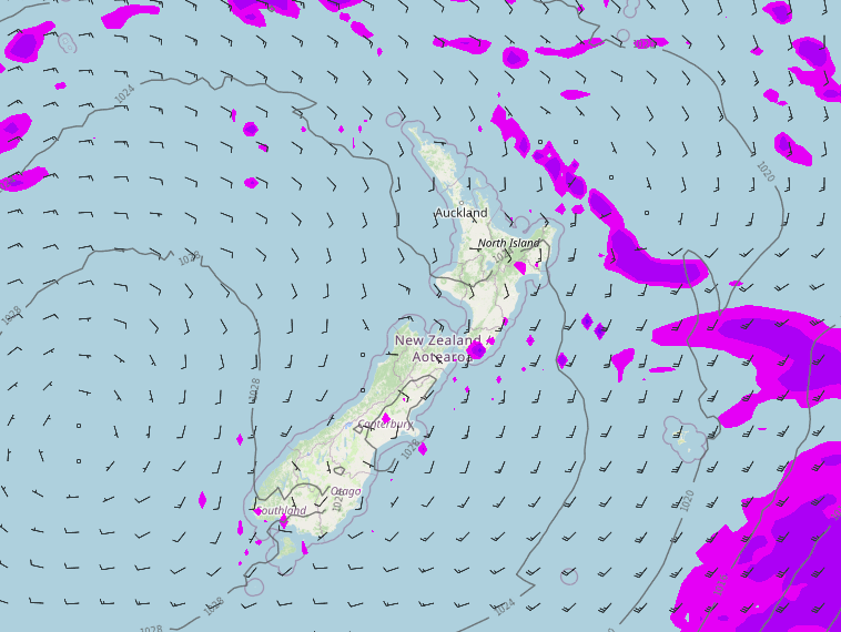
TEMPERATURES TODAY
High’s naturally today will be cooler in the east than they are out west thanks to a southerly quarter airflow, the upper North Island has the warmest temperatures of all with highs in the late teens or early twenties.
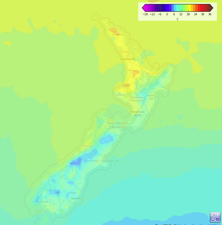
WARMING UP EASTERN SOUTH ISLAND FROM SATURDAY
The temperature profile over the second half of this week doesn’t change all that much from today although the South Island does warm up a touch more. But from Saturday the eastern South Island will noticeably feel warmer with highs getting into the late teens then on Sunday the early twenties.
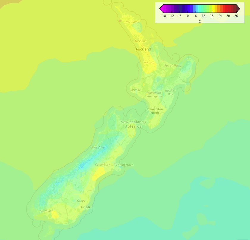
Temperature map – Saturday 3pm Temperature map – Sunday 3pm
Latest Video

Cold weekend, frosts return with high pressure, then a low late next week
The subantarctic airflow spreads over NZ today/tonight and into Saturday, dropping temperatures nationwide. Snow flurries are possible today to lower…
Related Articles
Cold weekend, frosts return with high pressure, then a low late next week
The subantarctic airflow spreads over NZ today/tonight and into Saturday, dropping temperatures nationwide. Snow flurries are possible today to lower…

Wintry burst of weather: Snow, squally showers then sunshine & frosts
A polar change (another one!) arrives on Friday for the South Island and goes nationwide on Saturday, leaving NZ under…

Antarctic southerly for parts of NZ Fri & Sat
For the first time this year a southerly from off Antarctica is heading towards the South Island, followed by more…

