Weather headlines (x3) for Tuesday: It’s wet!, Warm eastern NI Tomorrow, Snow far south tomorrow to 500m
11/07/2022 7:26pm
> From the WeatherWatch archives
Here’s what is making the weather headlines today.
IT’S WET! STRONG WINDS, SNOW IN THE SI HIGH COUNTRY
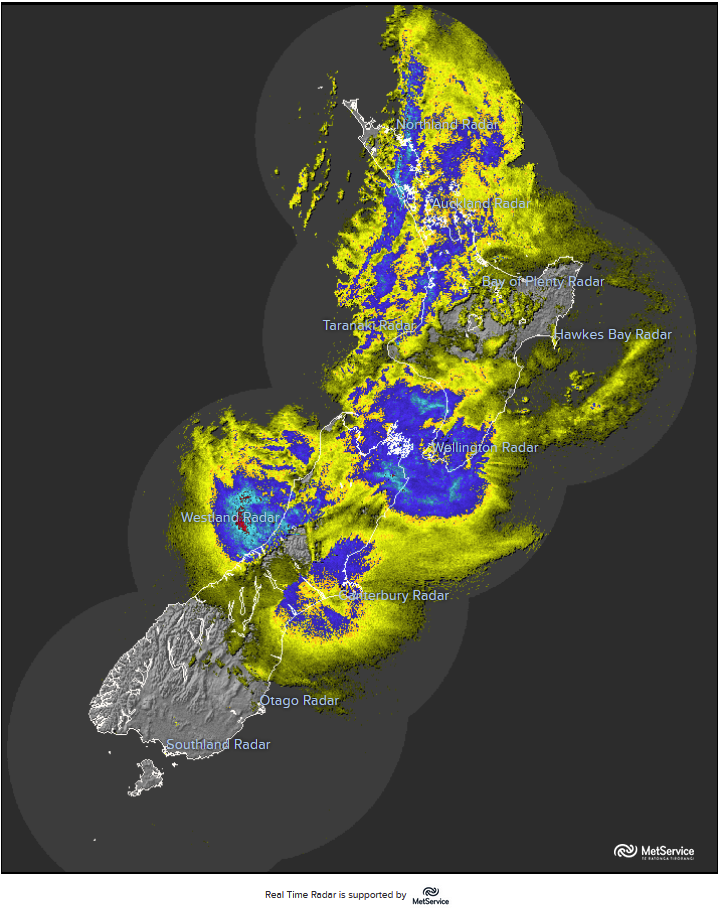
Certainly looking very wet out there, plenty of rain over New Zealand this morning apart from the far south which is still dry for now. Today we can also expect heavy snow about the South Island high country above about 500m and strong winds for certain regions too.
Many regions around New Zealand can expect some heavy rain but Nelson / Marlborough and down into Canterbury may expect some of the heaviest or at least much heavier rain then those regions are used to. Sometimes it’s not necessarily about how much rain does a particularly region get but also how well that area deals with a certain amount of rain.
For more details on today’s weather in relation to weather warnings from Metservice please visit this page here.
NICE DAY EASTERN NORTH ISLAND TOMORROW
As the low that is causing today’s unsettled weather moves away we can expect a northwesterly airflow for the North Island, this means in the east the weather is very nice for much of the day with temperatures reaching up to 18 to 20 degrees. Parts of Auckland and Northland reach into the late teens also but expect showers now and then.

MSLP / Rain map – Wednesday 3:00pm 
SNOW FOR THE FAR SOUTH TOMORROW ABOVE 500M
The other thing to note about tomorrow’s weather is southerlies driving into Southland and Otago which bring rain for much of the day and snow to 500m.
One rough way of figuring out how much snow you may get (above 500m) is if you search your location up on ruralweather.co.nz then see how much rain is due for you, say 25mm, then you could roughly expect 25cm of snow.
Latest Video

Rain & showers this weekend, colder change next week
Some places will warm up over the next day or so as a nor’wester out of Australia moves across NZ,…
Related Articles
Rain & showers this weekend, colder change next week
Some places will warm up over the next day or so as a nor’wester out of Australia moves across NZ,…

Temperature changes for some regions ahead of heavy West Coast rain
A nor-wester is about to kick in and it’s coming from out of Australia, boosting temperatures in some regions going…

NZ 7 day forecast: Showers, temp changes and heavy West Coast rain
NZ has a fairly messy forecast over the next 7 days, but the main feature will be heavy rain on…

