Weather headlines (x3) for Tuesday: Heavy rain today, Strong winds, Temperatures
25/07/2022 7:00pm
> From the WeatherWatch archives
Here’s what is making the weather headlines today.
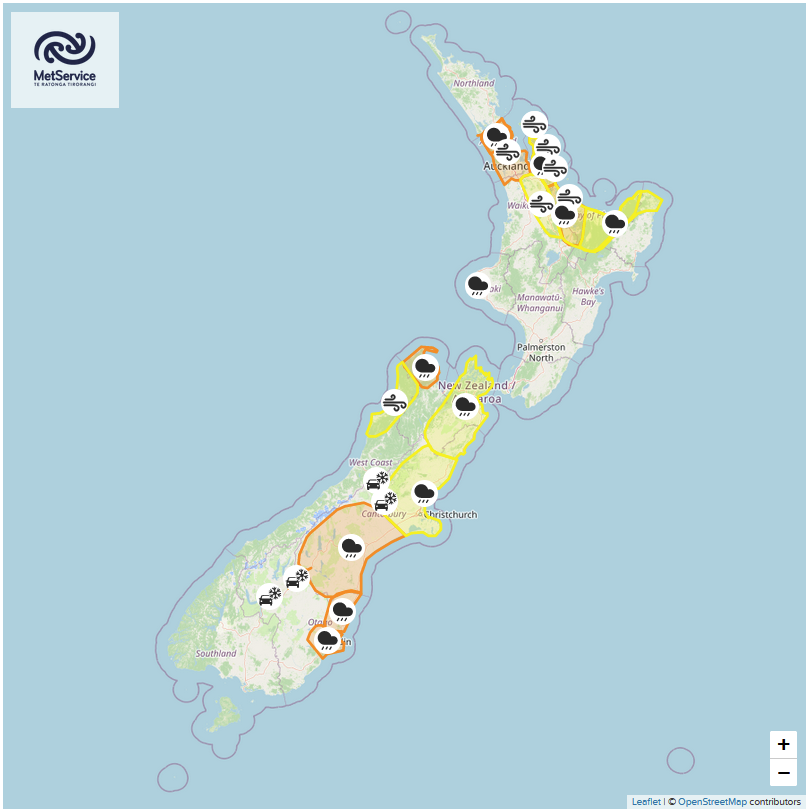
WHERE IS HEAVY RAIN TODAY
Expect heavy rain this morning for the Central North Island, Bay Of Plenty and across to East Cape, easing this afternoon as a front clears offshore to the east.
Later this afternoon or evening a burst of heavy showers moves in for Waikato and Taranaki then further south into Wellington later this evening.
Rain this morning for Nelson and Marlborough looks to be heavy then easing before midday, from this evening further heavy rain moves in.
Canterbury has rain, you could say it is boarding on heavy, more to the point is the persistence rain will have for South Canterbury, not easing till this evening or overnight. North Canterbury has the potential for heavy rain this morning then easing this afternoon to showers, Mid Canterbury’s weather is somewhere in the middle of the two above.
Finally for coastal Otago today expect rain all day long with totals potentially being fairly high, 100 to 130mm through to Wednesday morning.
For more details on today’s rain and any watches and warnings from Metservice please see this page here.

MSLP / Rain map – Tuesday 6:00am 
MSLP / Rain map – Tuesday 3:00pm 
MSLP / Rain map – Tuesday 9:00pm
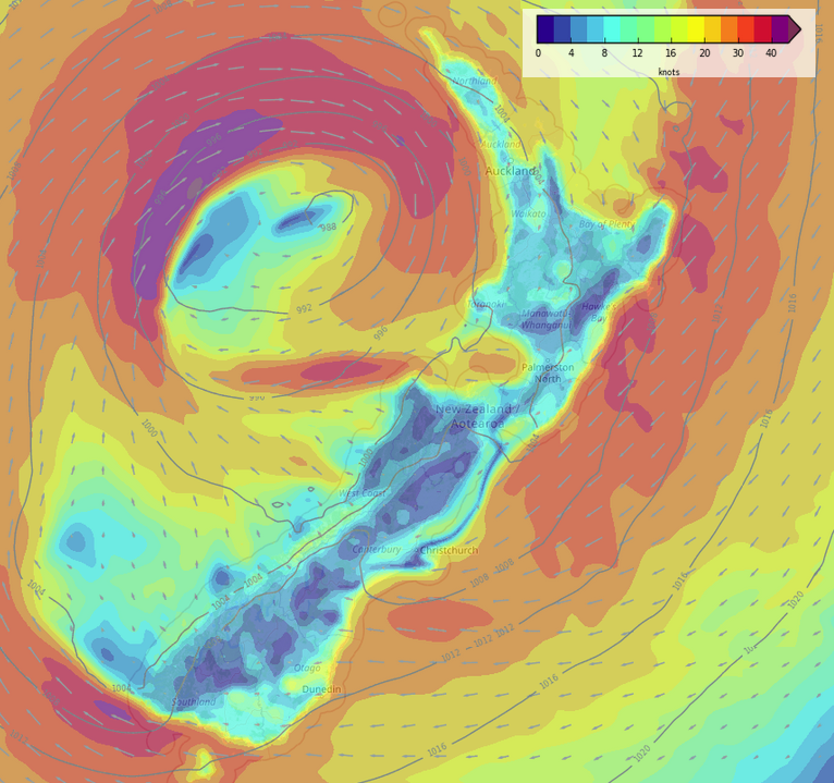
STRONG WINDS TODAY ALSO
Expect strong northeasterly winds for the eastern North Island this morning, winds may gust to gale about the coast then easing this afternoon. Meanwhile strong northerly winds develop for the upper North Island this morning, a chance of coastal gales also, mainly in the west from western Northland through to northern Taranaki.
Easterlies south of Banks Peninsula along the coast through to Southland are brisk to strong today, overnight the strongest winds will be about coastal Southland having eased further north.
Wind map – Tuesday 9:00am 
Wind map – Tuesday 3:00pm 
Wind map – Tuesday 9:00pm
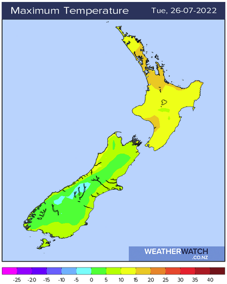
WARM TEMPERATURES MOVE INTO THE NORTH ISLAND
A northerly quarter airflow means temperatures lift over the North Island today with highs ranging in the mid to late teens for most.
Meanwhile in contrast, high’s about some parts of the South Island high country won’t escape 4 or 5 degrees.
Latest Video

Pockets of hit & miss heavy rain, snow moves northwards
Low pressure continues to slowly move across the upper North Island and for some that will bring the sun out,…
Related Articles
Pockets of hit & miss heavy rain, snow moves northwards
Low pressure continues to slowly move across the upper North Island and for some that will bring the sun out,…

Slow go for northern low & southern cold
For the next few days low pressure will crawl over the upper North Island, driving in rain as far south…

Slow moving low to track over northern NZ
A low pressure zone will slowly cross the North Island over the coming days, bringing hit and miss pockets of…

