Weather headlines (x3) for Thursday: Settled today, Strengthening northerlies for the South Island Friday, Cold air moves in Sunday
3/08/2022 7:00pm

> From the WeatherWatch archives
Here’s what is making the weather headlines today.
SETTLED TODAY, SOME MORNING FOG NORTH ISLAND
High pressure brings some settled weather today, mainly sunny with a touch of high cloud about. There is also areas of fog this morning for the North Island, these may move in again overnight.
Temperatures for eastern regions and much of the North Island will be in the late teens.
The West Coast is cloudy though with showers, rain for Fiordland is heavy for a time.
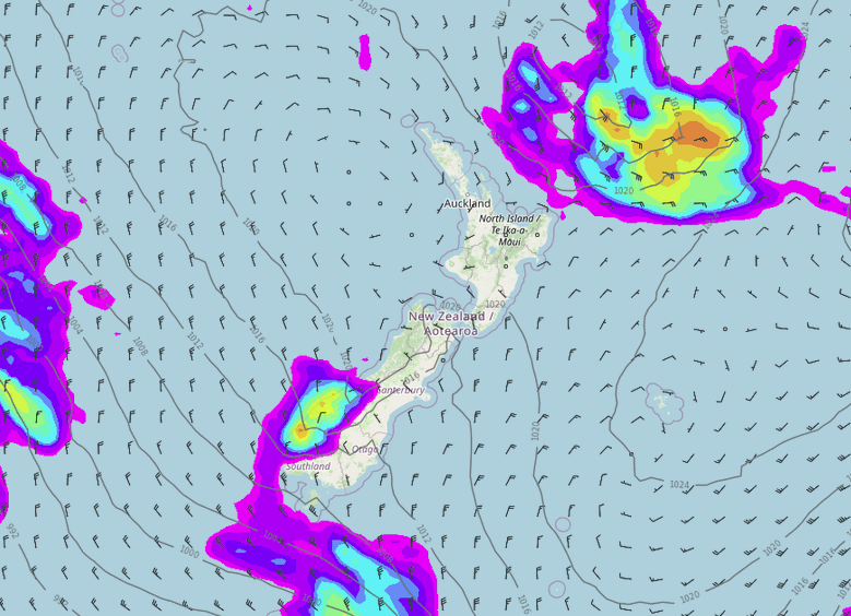
MSLP / Rain map – Thursday 3:00pm 
Fog risk this morning – Windy.com
STRENGTHENING NORTHERLIES FOR THE SOUTH ISLAND ON FRIDAY
Northerlies strengthen over the South Island on Friday, heavy rain moves into Fiordland in the afternoon reaching Greymouth in the evening.
Expect another warm day for eastern regions and much of the North Island with temperatures reaching into the late teens.

MSLP / Rain map – Friday 6:00pm 
Wind map – Friday 6:00pm 
COLD AIR MOVES IN FROM SUNDAY
Cold air starts moving into the eastern South Island on Sunday, and this means snow, possibly getting as low as 300m from morning in the south then further north through to southern Marlborough later in the day or overnight.
Monday through to Wednesday cold air hangs about the eastern South Island with snow around the 300m mark. Precipitation amounts are not heavy though so while snow is looking reasonably low it shouldn’t be heavy hour by hour. As we move into Kaikoura and southern Marlborough rain is more persistent on Tuesday and Wednesday but the snow level is a little higher, around 500m.


Latest Video

Temperature changes for some regions ahead of heavy West Coast rain
A nor-wester is about to kick in and it’s coming from out of Australia, boosting temperatures in some regions going…
Related Articles
Temperature changes for some regions ahead of heavy West Coast rain
A nor-wester is about to kick in and it’s coming from out of Australia, boosting temperatures in some regions going…

NZ 7 day forecast: Showers, temp changes and heavy West Coast rain
NZ has a fairly messy forecast over the next 7 days, but the main feature will be heavy rain on…

Cold fronts continue, wind & rain for some Fri/Sat
Wet weather is moving over the North Island today, while the South Island has drier skies – ahead of another…

