Weather headlines (x3) for Monday: Warm for Canterbury, Settled week on the way, Showers in the northeast
1/05/2022 7:00pm

> From the WeatherWatch archives
Here’s what is making the weather headlines today.
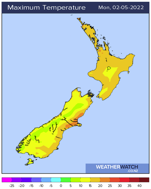
WARM FOR CANTERBURY
Thanks to a northwesterly airflow lying across the South Island temperatures for the eastern South Island will be nice and warm this afternoon, especially for Canterbury. Winds are not strong either. Interestingly there may be a light southerly breeze develop south of Banks Peninsula along the coast after midday.
As we can see Christchurch is set to reach 22, but it may even get to as high as 23 or 34. Then the rest of the week while not as warm is still reasonable for the time of year with temperatures in the late teens.
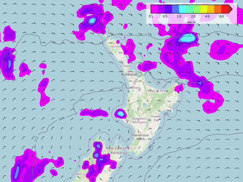
ANOTHER SETTLED WEEK ON THE WAY
The week ahead looks quite settled and mainly dry, there is the odd shower about with today’s shower or rain activity on the West Coast probably as wet as anywhere is going to get at least for the next 6 days. On Sunday we start to see a beefy front move onto the South Island from the usual westerly direction although this mainly brings rain in the west.
As we can see in the map below which I’m sure many of you are familiar with now New Zealand is looking quite dry (this map runs through to midday 9th May), but yes the West Coast gets some rain.

TUESDAY THROUGH TO THE WEEKEND, SHOWERS IN THE NORTHEAST
Due to the positioning of an anticyclone for the week ahead and the airflow moving around it, the odd shower will continue at times for northeastern parts of the North Island. This is mainly for East Cape then Coromandel northwards in the east thanks to an easterly quarter airflow. But it’s only really enough to perhaps bring a little annoyance at times, by in large it’s still looking mainly dry even there looking forward.
Latest Video

Slow go for northern low & southern cold
For the next few days low pressure will crawl over the upper North Island, driving in rain as far south…
Related Articles
Slow go for northern low & southern cold
For the next few days low pressure will crawl over the upper North Island, driving in rain as far south…

Slow moving low to track over northern NZ
A low pressure zone will slowly cross the North Island over the coming days, bringing hit and miss pockets of…

NI low pressure, SI polar change
Low pressure will move over the upper North Island this week, bringing hit and miss pockets of heavier rain into…

