Weather headlines (x3) for Friday: Heavy rain moves away, Snow flurries SI high country, Heavy frosts Sat morning
14/07/2022 7:00pm

> From the WeatherWatch archives
Here’s what is making the weather headlines today.
HEAVY RAIN AND LOW MOVES AWAY
Some heavy rain for the Central North Island and about the east coast eases this morning to showers and dry areas increase this afternoon, at the same time an area of low pressure moves away to the southeast.
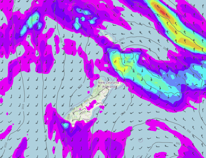
MSLP / Rain map – Friday 6:00am 
MSLP / Rain map – Friday 12:00pm
SNOW FLURRIES ABOUT THE FAR SOUTH AND UPPER SOUTH ISLAND
Showers continues to push into the lower South Island today (Southland and Otago), expect snow to about 500m but this may get as low as 400m.
Showers about South and Mid Canterbury (more so inland) move into North Canterbury, Nelson and Marlborough this afternoon. Some snow may fall to 500m in the high country.
VERY HEAVY FROSTS – SOUTH ISLAND ON SATURDAY MORNING
Temperatures may get as low as -8 to -10 about the inner South Island overnight tonight into Saturday morning. It won’t warm up very much in the afternoon for the inner South Island either, perhaps not even getting above 0 degrees!

Latest Video

Pockets of hit & miss heavy rain, snow moves northwards
Low pressure continues to slowly move across the upper North Island and for some that will bring the sun out,…
Related Articles
Pockets of hit & miss heavy rain, snow moves northwards
Low pressure continues to slowly move across the upper North Island and for some that will bring the sun out,…

Slow go for northern low & southern cold
For the next few days low pressure will crawl over the upper North Island, driving in rain as far south…

Slow moving low to track over northern NZ
A low pressure zone will slowly cross the North Island over the coming days, bringing hit and miss pockets of…

