Weather Headlines for Wednesday (x3): Heavy rain West Coast, Rain potential in the north and warm overnight lows
1/02/2022 6:00pm

> From the WeatherWatch archives
HEAVY RAIN WEST COAST
The West Coast has heavy rain on the way today, continuing on Thursday then gradually on Friday the heaviest rain shifts north to lie over Buller and Tasman. Up to 500 – 750mm of rain is possible about the ranges of Westland and 150 – 250mm nearer the coast. Please keep up to date with the latest warnings by clicking here.
NORTH ISLAND MAY GET HEAVY RAIN FROM SUNDAY
There has been a shift in some models indicating the North Island could get some decent rain from Sunday, a combination of the front that will deliver heavy rain to the West Coast this week moving northwards and some very humid tropical air combine to bring this potential rain maker. There is still room for some details to change here but the models show promise. Although we don’t want too much in one hit as after a dry spell this can cause flooding issues. More at this link here.

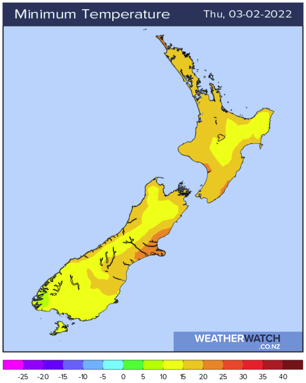
WARM OVERNIGHT LOWS
Overnight last night through to this weekend for the North Island overnight lows are going to be very warm; especially for the upper North Island with temperatures not getting below the high teens or perhaps early twenties at times. Canterbury tops the lot though where overnight lows may not dip below the early to mid twenties tonight.
Latest Video

Cold weekend, frosts return with high pressure, then a low late next week
The subantarctic airflow spreads over NZ today/tonight and into Saturday, dropping temperatures nationwide. Snow flurries are possible today to lower…
Related Articles
Cold weekend, frosts return with high pressure, then a low late next week
The subantarctic airflow spreads over NZ today/tonight and into Saturday, dropping temperatures nationwide. Snow flurries are possible today to lower…

Wintry burst of weather: Snow, squally showers then sunshine & frosts
A polar change (another one!) arrives on Friday for the South Island and goes nationwide on Saturday, leaving NZ under…

Antarctic southerly for parts of NZ Fri & Sat
For the first time this year a southerly from off Antarctica is heading towards the South Island, followed by more…

