Weather Headlines for Thursday – Front, temperature drop and chilly mornings
19/01/2022 4:00pm

> From the WeatherWatch archives
Cold front moving through today
A cold front pushes over the North Island today. Rain totals for this front / event including yesterday’s falls for the South Island and the remaining clearing showers for the North Island on Friday are as follows:
Invercargill 5-10mm, Alexandra 5-10mm, Dunedin 15-20mm, Hokitika 30-40mm, Christchurch 10mm, Blenheim / Nelson 5-10mm, Wellington 20mm, Napier 10mm, Waiouru 5-10mm, New Plymouth 5-10mm, Hamilton 1-2mm, Tauranga 0.5-1mm, Auckland 0.5mm, Kaitaia 0-0.5mm
As you can see the upper North Island which needs it most gets the least unfortunately. More details at the link below.
https://www.ruralweather.co.nz/content/showers-rain-moving-up-nz-next-48-hours-front-weakens-as-it-heads-north-2-maps
Temperature drop
With the cold front mentioned above there will be a noticeable drop in temperatures. Christchurch may be hard pressed to get out of the high teens today while yesterday Canterbury was quite warm. A drop in temperatures will be felt for the North Island today also however the upper North Island may just notice more of a refreshing feel to conditions.

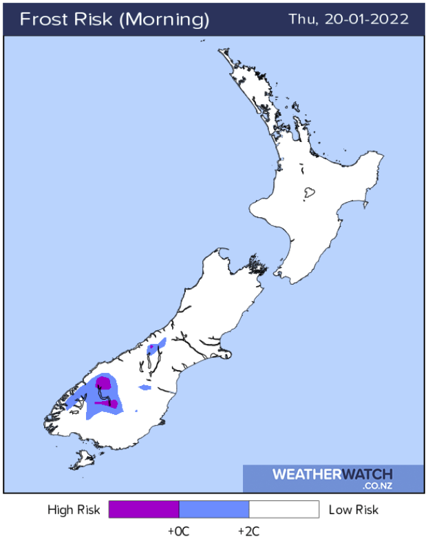
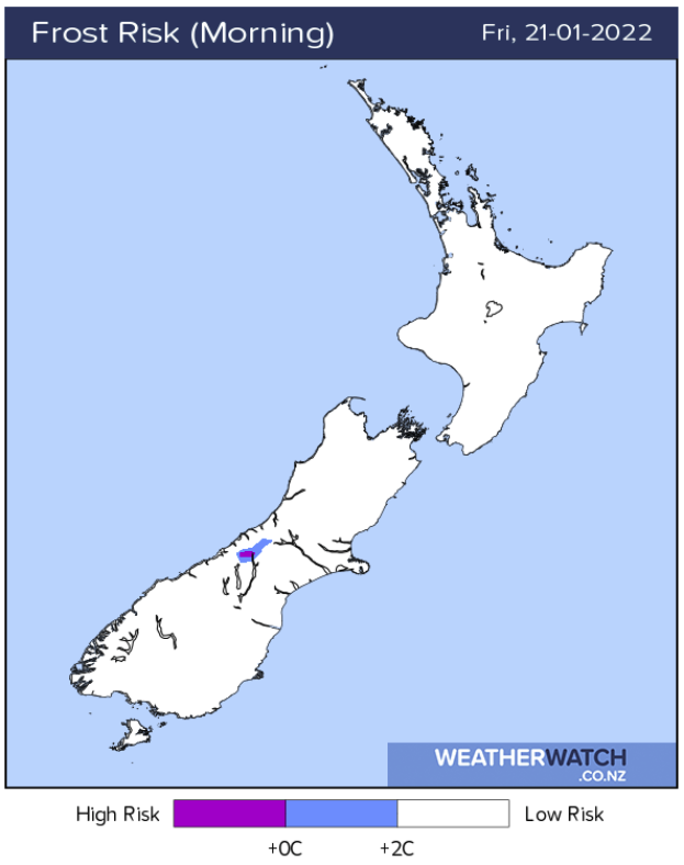
A frost on Thursday / Friday morning?
While not overly likely some inland parts of the South Island will be pretty chilly on Thursday and Friday morning, alpine areas may start the day on only a couple of degrees.
Comments
Latest Video

Slow go for northern low & southern cold
For the next few days low pressure will crawl over the upper North Island, driving in rain as far south…
Related Articles
Slow go for northern low & southern cold
For the next few days low pressure will crawl over the upper North Island, driving in rain as far south…

Slow moving low to track over northern NZ
A low pressure zone will slowly cross the North Island over the coming days, bringing hit and miss pockets of…

NI low pressure, SI polar change
Low pressure will move over the upper North Island this week, bringing hit and miss pockets of heavier rain into…


Alice on 19/01/2022 11:28pm
Noticing the change in cloud and temperature right now! WW comes in again on top with forecasting!