Weather Headlines for Thursday – Cooling down, humidity leaves (for now) then settled
26/01/2022 6:00pm
> From the WeatherWatch archives
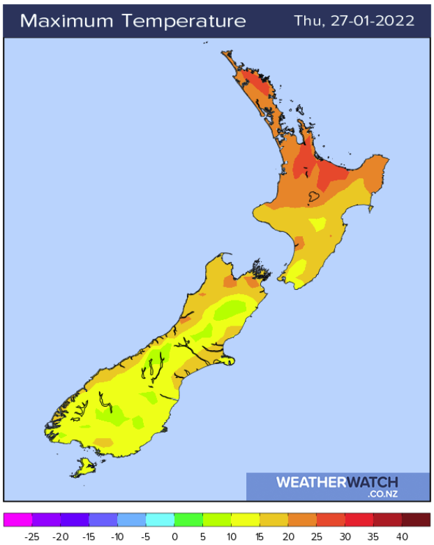
Cooler in the east today but upper North Island still hot
A southwesterly airflow lies over New Zealand today and it will feel a bit cooler for most regions especially in the east however the upper North Island is still hot with temperatures about the Waikato getting into the late twenties.
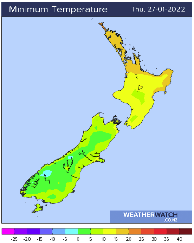
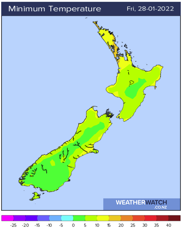
Chilly starts
It will be a cool start about Central Otago through to the Mackenzie Country starting out around 5 degrees or perhaps a touch lower this morning and tomorrow morning, the Central Plateau in the North Island has a cold start on Friday morning also.
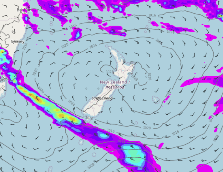
A settled weekend on the way
This coming weekend is looking nice and settled with an anticyclone covering the country, it hangs around for the first half of next week also although it will slowly slip out to the east. Temperatures will really start to bounce back for the South Island on Saturday getting into the mid to late twenties, perhaps early thirties for inland spots. Early February we may see some rain as an ex tropical cyclone descends into the Tasman Sea from the tropics then moves close to western regions.
Latest Video

Snow, rain showers & cold polar southerlies set to return
Friday will be a wintry day across NZ as the next cold front arrives, bringing snow to lower levels of…
Related Articles
Snow, rain showers & cold polar southerlies set to return
Friday will be a wintry day across NZ as the next cold front arrives, bringing snow to lower levels of…

Frosts, late week rain & another cold weekend coming
High pressure will cross NZ over the next few days meaning more cold nights/mornings with frosts, but a nor’wester will…

NZ: Cold & windy, then calm & frosty
Downpours, some squally with the chance of thunderstorms and even small tornadoes are possible for parts of NZ over Friday…

