Weather Headlines for Friday – Settled and becoming warm, hopefully some rain early February
27/01/2022 6:00pm
> From the WeatherWatch archives
Settled from Friday through to early next week
An anticyclone moves over New Zealand today and hangs around this weekend and early next week, this brings mainly dry and settled weather.

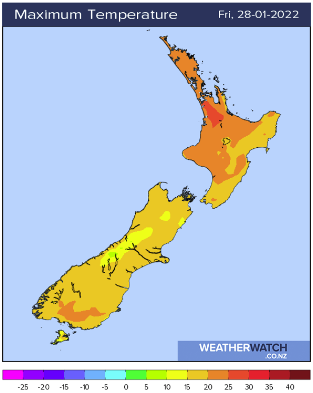
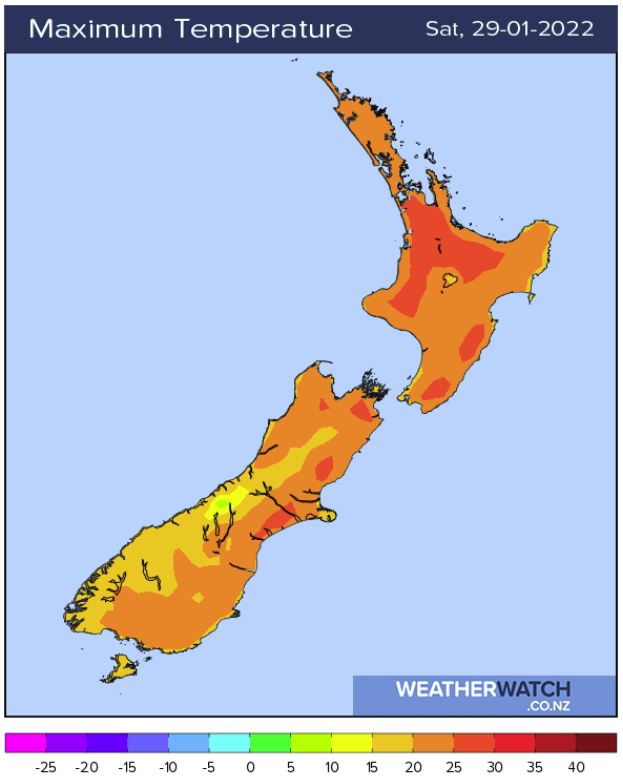
Temperatures warm up inner South Island Friday
Yesterday was cooler for the South Island but this afternoon temperatures about inland areas will already be climbing up into the high twenties (Central Otago, Mackenzie Country), Saturday sees many South Island regions bounce back into the mid to late twenties perhaps even early thirties inland. Meanwhile the North Island has afternoon temperatures mostly in the mid to late twenties apart from a few coastal spots with onshore winds.
Rain moving in early February
After some settled weather hopefully there will be some rain develop about northern and western regions early February thanks to a low descending into the Tasman Sea from the tropics. More info by clicking here.
Comments
Latest Video

Cold weekend, frosts return with high pressure, then a low late next week
The subantarctic airflow spreads over NZ today/tonight and into Saturday, dropping temperatures nationwide. Snow flurries are possible today to lower…
Related Articles
Cold weekend, frosts return with high pressure, then a low late next week
The subantarctic airflow spreads over NZ today/tonight and into Saturday, dropping temperatures nationwide. Snow flurries are possible today to lower…

Wintry burst of weather: Snow, squally showers then sunshine & frosts
A polar change (another one!) arrives on Friday for the South Island and goes nationwide on Saturday, leaving NZ under…

Antarctic southerly for parts of NZ Fri & Sat
For the first time this year a southerly from off Antarctica is heading towards the South Island, followed by more…


Peter Thomas Langer on 27/01/2022 10:21pm
i wish i had 3 wet summers like aus and parts of the south island if you think the south island hasnt study niwas maps