VIDEO: Your updated Labour Weekend forecast
20/10/2025 11:34pm
We have the latest on the long weekend weather – and the build up to the weekend – as significant storms south of NZ churn by, and high pressure remains just to our north.
This classic spring pattern means the ‘squash zone’ of air pressure lies right over NZ – so windy weather will surge off and on this week – and again this long weekend. There will be calmer spells too.
The bulk of the rain is on the West Coast with showers into the western North Island too. Eastern areas look driest – although heavy West Coast rain may affect the waterways in Otago and Canterbury.
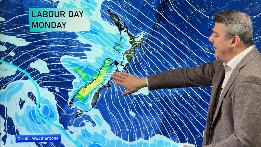
On Labour Day Monday (still not 100% locked in) low pressure looks to bring another surge of nor’west gales and heavy western rain, although some in the north and east may not have wet weather (or not until later at least).
This is yet to be fine tuned, but here’s the current forecast for the next week ahead.
*Programming Note:
We also have a special severe weather video out today too.
Latest Video

Polar airflows set to bring cold weekend to NZ
Nor-west winds will be building over parts of NZ going into Thursday with rain on the West Coast becoming heavy…
Related Articles

Wind, rain, showers & a noticeable temperature drop for all
It will be a colder weekend right across NZ as a sub-Antarctic southerly blows through, bringing frosts, snow flurries and…
Polar airflows set to bring cold weekend to NZ
Nor-west winds will be building over parts of NZ going into Thursday with rain on the West Coast becoming heavy…

Update on incoming cold change for NZ
High pressure still covers NZ but that will slide offshore as we go into Friday and the weekend as a…

