VIDEO: NZ’s long weekend forecast + a new pattern is forming
12/07/2023 12:45am

> From the WeatherWatch archives
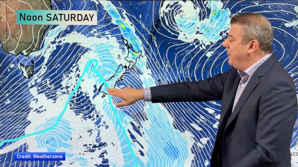
The last long weekend until late October is upon us and the forecast isn’t too bad considering the time of year we’re in! The west to south west flow will continue on this weekend with gusty winds in some places (like Cook Strait and coastal areas to the west).
There will be a few showers in the west too – but long dry spells. Eastern areas are mostly or even completely dry this long weekend.
This weather comes after a snowy change today for some in the South Island, but this eases on Thursday and fades quickly as westerlies return. Australia is very settled with a lot of high pressure which will drift southwards, bringing lighter winds next week to the southern states.
While El Nino isn’t yet officially with us, the weather pattern is sure starting to look like it now in our part of the world. Our location on earth means things can change quickly, but long term we’re seeing more West to South-West winds for NZ and more high pressure for Australia and the Tasman Sea for the remainder of July.
**Programming Notes**
– Our small team is reduced this week due to school hols, so we don’t have our usual editing for audio and video – and a slightly later publishing time. That’s why our videos look/sound a little different this week.
– No weather video from us this Friday (July 14th), due to Matariki public holiday.
Comments
Before you add a new comment, take note this story was published on 12 Jul 2023.


Add new comment
Anton on 12/07/2023 11:03pm
Hi great videos, to keep us all in the loop.
I live in titahi bay Porirua,be interesting to know how less windy it’s been here than normal. (As it’s been not like windy Wellington at all for months now, drier too.
Reply
WW Forecast Team on 12/07/2023 11:20pm
Hi Anton, thanks for the feedback. Yes we’ve had a few comments from Wellingtonians about how there’s been a lack of wind this winter/year! We’re now shifting gears into westerlies so I’d expect Wellington to get windier weather in the months ahead. Unfortunately tax funded weather observations have been commercialised so aggressively by NIWA we cannot share wind and sunshine hours freely with you. You’ll need to contact them directly to get this public tax funded data. Despite 15 years of Government agreeing it’s wrong to commercialise this data, the Government – particularly in recent years – has only made it harder for us to access it.
Phil D
Reply
Andrew on 12/07/2023 2:27am
It really has been a year of slow moving systems and patterns.
NE flows lasting a week or more, stalling cyclones, stationary disintegrating Tasman lows, and now a meek and mild (for the time of year) SW flow that promises to fill up most of the rest of July!
Reply
WW Forecast Team on 12/07/2023 2:44am
Hi Andrew, yes quite right, it’s all slower moving and the southerly air current isn’t punching through so much into the mix now that the highs have shifted further north over Aussie. The Southern Ocean area is highly active and very stormy now – there’s always that possibility a storm or polar southerly could randomly ‘spice’ things up for NZ in the coming few months! But if the westerly flow continues to dominate, then those wintry changes will struggle to linger very long in NZ – or go that far north.
– Phil D
Reply