VIDEO: NZ enters peak winter as cold air dominates next week or two
7/08/2025 12:33am
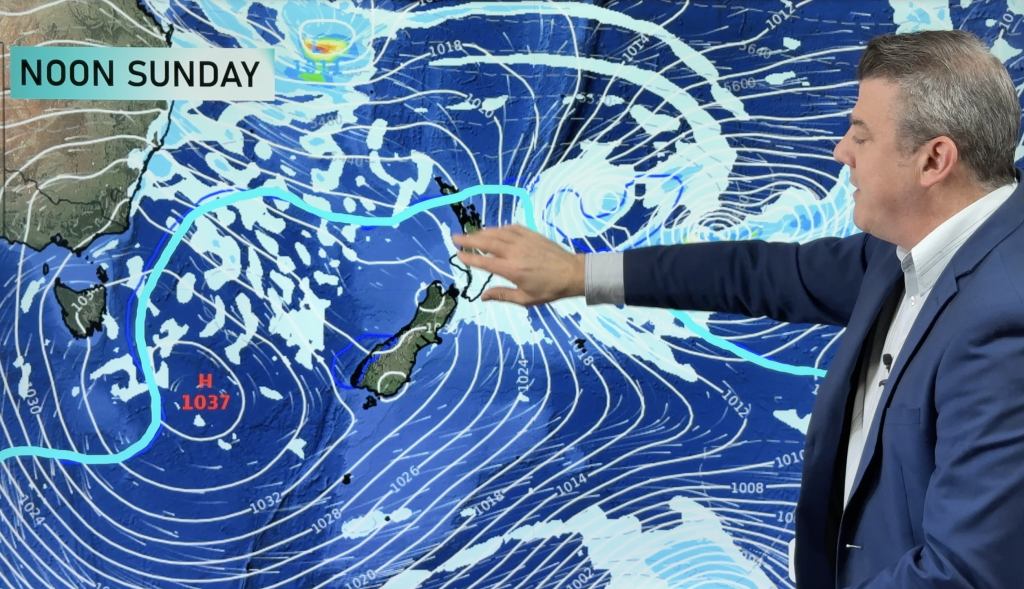
Friday sees wet weather crossing NZ from the west ahead of a colder weekend – and a cold week next week for many places as frosts and high pressure return.
There may be some snow to 300 metres in the South Island and around the North Island’s Central Plateau on Friday/Saturday (including the Desert Road).
Next week high pressure moves into the South Island with widespread frosts and low temperatures – this affects the North Island too, but an easterly flow means eastern areas have more cloud and showers, western areas sunnier/drier – although northern NZ will be close (again) to a subtropical low which may feed more easterlies, cloud and showers in to the upper North Island.
EARLY HEADS UP:
We also take a long range look 12 days away at a *potential* wintry/snowy outbreak for New Zealand – we show you the long range modelling for that.
Comments
Latest Video

NZ: 8 Day outlook as gales & rain ease, high pressure builds
Damaging wind gusts and heavy rain will continue to affect some parts of the North Island and brushing Marlborough today…
Related Articles
NZ: 8 Day outlook as gales & rain ease, high pressure builds
Damaging wind gusts and heavy rain will continue to affect some parts of the North Island and brushing Marlborough today…

Pockets of hit & miss heavy rain, snow moves northwards
Low pressure continues to slowly move across the upper North Island and for some that will bring the sun out,…

Slow go for northern low & southern cold
For the next few days low pressure will crawl over the upper North Island, driving in rain as far south…


Joann on 8/08/2025 7:02pm
Well presented very clear as he explains our weather that’s coming in Well done
WW Forecast Team on 11/08/2025 10:37pm
Thank you Joann 🙂
– WW