Updated wind & rain maps for incoming low (+8)
29/11/2020 6:07pm

> From the WeatherWatch archives
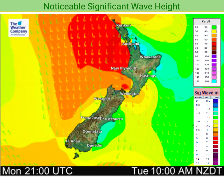
A small low moves into New Zealand later today and on Tuesday interacts with an incoming high to create a burst of windy southerlies.
These winds will be strongest through – and around – the Cook Strait area with gusts over 120km/h possible.
Auckland and other areas hugging the western coastline of the upper North Island may also experience gales on Tuesday as the southerly out of Cook Strait heads northwards.
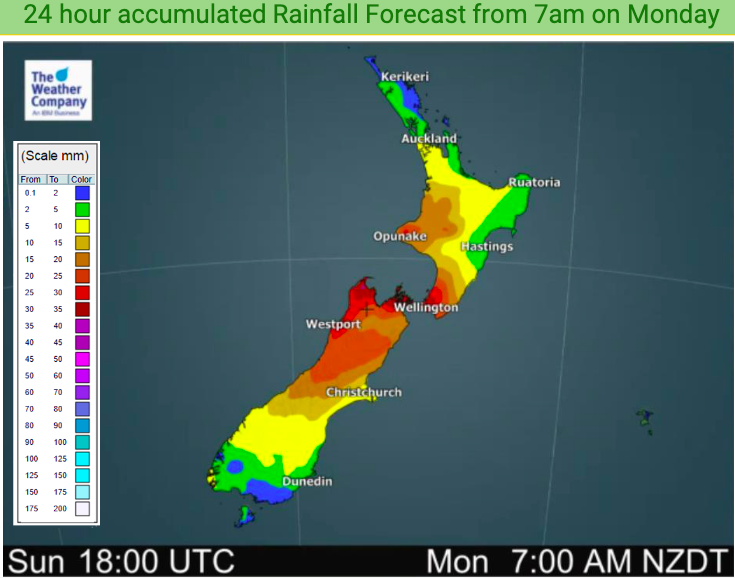
Rain is fairly evenly spread in the days ahead with central NZ most exposed (both western and eastern sides) while the very north and very south of the nation remains fairly dry – including Auckland and Dunedin.


Latest Video

Slow moving low to track over northern NZ
A low pressure zone will slowly cross the North Island over the coming days, bringing hit and miss pockets of…
Related Articles
Slow moving low to track over northern NZ
A low pressure zone will slowly cross the North Island over the coming days, bringing hit and miss pockets of…

NI low pressure, SI polar change
Low pressure will move over the upper North Island this week, bringing hit and miss pockets of heavier rain into…

Rain & showers this weekend, colder change next week
Some places will warm up over the next day or so as a nor’wester out of Australia moves across NZ,…

