Tuesday’s weather headlines (x3): Warm in the east, Cold front far south tonight, Frost risk coming up
4/04/2022 8:31pm

> From the WeatherWatch archives
Here’s what is making the weather headlines today.
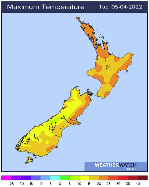
WARM IN THE EAST, WET IN THE WEST
A northwesterly airflow lies over New Zealand today with showers for the western North Island and rain for the West Coast, eastern regions as a matter of circumstance are dry and warm with temperatures reaching into the mid twenties for some spots. The eastern North Island will be the warmest of all.
The upper North Island despite having a few showers about still warms up though with high’s peaking around 23 or 24 degrees.
COLD FRONT DUE TONIGHT ABOUT THE FAR SOUTH
A cold front moves into the lower South Island later this evening bringing rain then pushes northwards to reach the lower North Island on Wednesday evening. Expect rain in the west and south, showers for the eastern South Island as the front moves northwards. Once it reaches the lower North Island Wednesday evening, Wellington and Wairarapa may get some heavy rain for a time.
Southwesterlies become strong to gale force about eastern coastal areas on Wednesday then hitting Wellington and coastal Wairarapa in the evening.
The final piece of the puzzle is there is some cold air moving onto the lower South Island later on Wednesday and this brings a few snow flurries to about 700 or 600m for Southland and Otago. Precipitation levels are minimal so any snow flurries aren’t likely to cause any issues but it is a sign winter is getting closer.

COLD SOUTHERLIES THEN AN ANTICYCLONE, WHAT DOES THAT EQUAL? FROSTS
An anticyclone starts to nudge in a little from Thursday as southerly quarter winds over New Zealand ease, this means potentially a frosty start for inland parts of the South Island in the morning. Friday and Saturday mornings have a risk of frost also. Keep up to date with the coming frost risk here.
Latest Video

More heavy rain, snow – but large dry areas, especially as we go into the long weekend
Heavy rain will continue for parts of Canterbury and Marlborough over the next day or two and it will gradually…
Related Articles
More heavy rain, snow – but large dry areas, especially as we go into the long weekend
Heavy rain will continue for parts of Canterbury and Marlborough over the next day or two and it will gradually…

Large low brings rain, downpours & some snow – gets colder as the week progresses
Low pressure will cross the upper North Island in the days ahead and that set-up actually pushes more heavy rain…

WeatherWatch App launches real-time local lightning tracker!
A bolt out of the blue! WeatherWatch has launched a live, real-time lightning tracker, enabling Kiwis to gain access to data provided by the…

