Tuesday’s national forecast – Cold front pushes through (+9 maps)
26/04/2021 4:22pm

> From the WeatherWatch archives
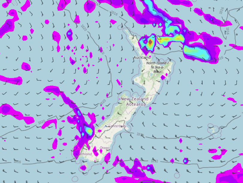
A cold front pushes over the North Island today meanwhile the South Island is in a southwesterly airflow.
North Island
A cold front pushes up the western side Taranaki northwards this afternoon bringing showers, possibly heavy with a risk of thunder then easing this evening and clearing later / overnight. Showers in the southwest start to clear this afternoon and sun breaks through. Showers about Wairarapa push into Hawkes Bay then Gisborne this afternoon with a southwest change, clearing Wairarapa this evening.
South Island
Mostly sunny for the West Coast but showers Greymouth northwards clear during this morning. Nelson and Marlborough see cloudy areas today, there could be the odd shower on and off. Showers clear Canterbury this afternoon, showers about the far south ease this afternoon and clear this evening.


Latest Video

Some polar airflows but more high pressure to affect NZ’s weather
Showers are in the forecast over the next several days, we track where and when they occur – but there…
Related Articles
Some polar airflows but more high pressure to affect NZ’s weather
Showers are in the forecast over the next several days, we track where and when they occur – but there…

Tracking the showers & colder changes
High pressure isn’t over NZ, but is nearby – and it’s affecting our airflows and who gets wet weather and…

Westerlies continue, sub-tropical for some
West to north-west winds blow through the South Island and lower North Island today bring heavy West Coast rain and…

