Thursday’s weather headlines (x3): High is large and in charge, cold front moves northwards late Friday
16/02/2022 6:00pm

> From the WeatherWatch archives
HIGH PRESSURE LARGE AND IN CHARGE
A large high pressure system lies over New Zealand today bringing settled weather. Winds are mainly light however east to northeast breezes may freshen up a little about eastern coastal areas this afternoon, especially the eastern South Island. There is a few showers about East Cape for the North Island and later today a few drizzle patches move into Fiordland with northerlies.
HEAVY RAIN FOR FIORDLAND OVERNIGHT FRIDAY
As a cold front moves onto the lower South Island overnight Friday / early Saturday morning heavy rain can be expected for Fiordland.
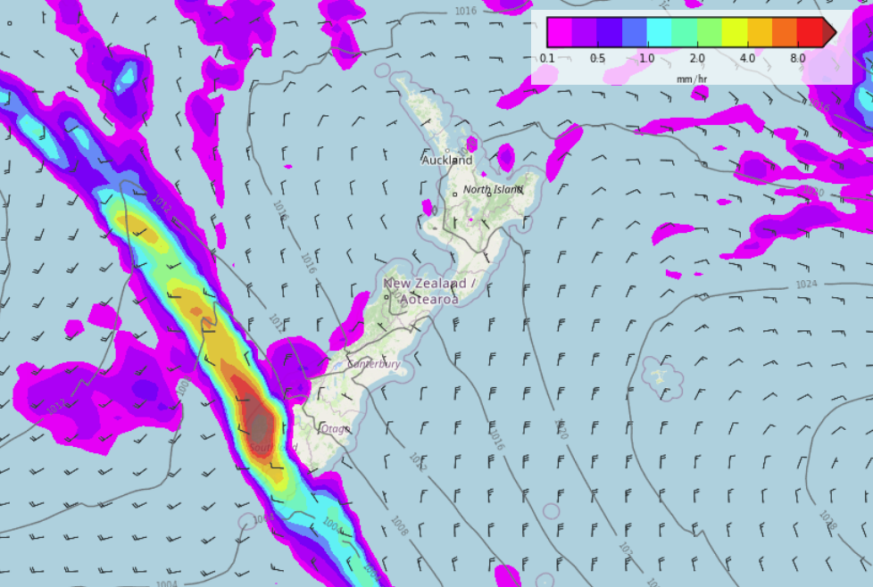

COLD FRONT MOVES NORTHWARDS ON SATURDAY
As the cold front mentioned above pushes northwards over the South Island, it will deliver rain to the West Coast (possibly heavy). Southland and Otago have some morning rain then clearing away in the afternoon, Canterbury sees some rain by evening then clearing overnight for most although perhaps lingering into Sunday morning for northern parts of North Canterbury then clearing away there.

Latest Video

Slow go for northern low & southern cold
For the next few days low pressure will crawl over the upper North Island, driving in rain as far south…
Related Articles
Slow go for northern low & southern cold
For the next few days low pressure will crawl over the upper North Island, driving in rain as far south…

Slow moving low to track over northern NZ
A low pressure zone will slowly cross the North Island over the coming days, bringing hit and miss pockets of…

NI low pressure, SI polar change
Low pressure will move over the upper North Island this week, bringing hit and miss pockets of heavier rain into…

