Thursday’s national forecast – Mainly settled today, a few showers in the northeast
23/02/2022 11:08am
> From the WeatherWatch archives
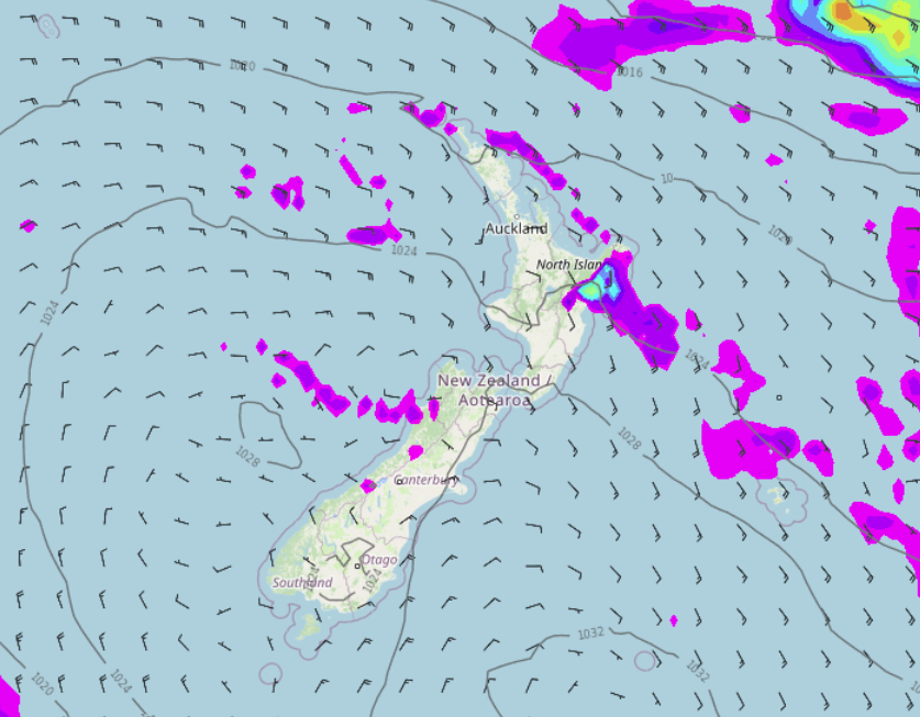
An anticyclone covers most of New Zealand today bringing mainly settled weather, winds moving around this high come in as a southeast for the North Island so a few showers can be expected for Hawkes Bay and Gisborne, also north of Auckland.
Northland, Auckland, Waikato & Bay Of Plenty
Mostly sunny with some afternoon cloud, morning showers north of Auckland clear away although clinging to northern parts of Northland for much of the day. Overnight a few showers move in for Coromandel through to eastern Northland. East to southeasterly winds.
Highs: 24-27
Western North Island (including Central North Island)
Mostly sunny, some cloud closer to the eastern ranges. Southeasterly winds, easterlies about the Central Plateau.
Highs: 18-26
Eastern North Island
Mostly cloudy, showers for Hawkes Bay and Gisborne. Wairarapa is mainly dry with cloud breaking to afternoon sunny spells. Cool south to southeasterly winds
Highs: 19-21
Wellington
Morning cloud then mostly sunny, southeasterly winds.
Highs: 18-21
Marlborough & Nelson
Morning cloud then sunny spells increase in the afternoon, east to southeasterly winds. Afternoon northerlies for Nelson.
Highs: 18-21
Canterbury
Morning low cloud (fog inland) then sunny spells break through in the afternoon, breezy east to northeasterly winds.
Highs: 17-22
West Coast
Morning cloud then increasing sunny spells, north of about Greymouth expect the odd shower. Light winds tend to the west or southwest after midday.
Highs: 21-24
Southland & Otago
Morning low cloud or fog then mostly sunny, fog again overnight. Coastal Otago has morning cloud then sunny spells. Light winds for most but east to northeasterly winds a bit breezy for coastal Otago.
Highs: 19-24
Latest Video

Rain & showers this weekend, colder change next week
Some places will warm up over the next day or so as a nor’wester out of Australia moves across NZ,…
Related Articles
Rain & showers this weekend, colder change next week
Some places will warm up over the next day or so as a nor’wester out of Australia moves across NZ,…

Temperature changes for some regions ahead of heavy West Coast rain
A nor-wester is about to kick in and it’s coming from out of Australia, boosting temperatures in some regions going…

NZ 7 day forecast: Showers, temp changes and heavy West Coast rain
NZ has a fairly messy forecast over the next 7 days, but the main feature will be heavy rain on…

