> From the WeatherWatch archives
A small low is moving down the North Island today and will bring a burst of heavy rain and gales too.
The surge of gales is short lived – and not for all, but those exposed may see gusts 75 to 100km/h and a few power outages as some tree branches break.
It’s a bit of a tricky system to forecast when the low is so small – but the placement of this low just helps ramp up the winds a little further.
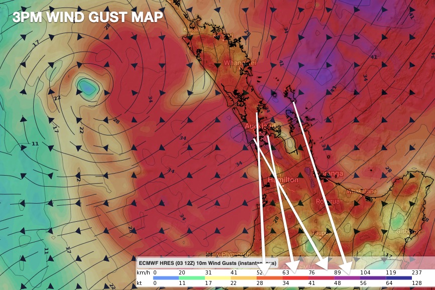
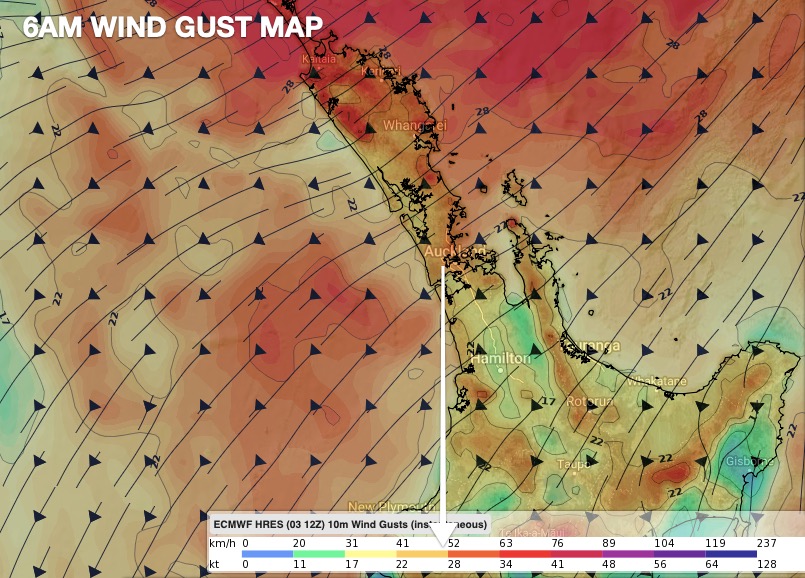
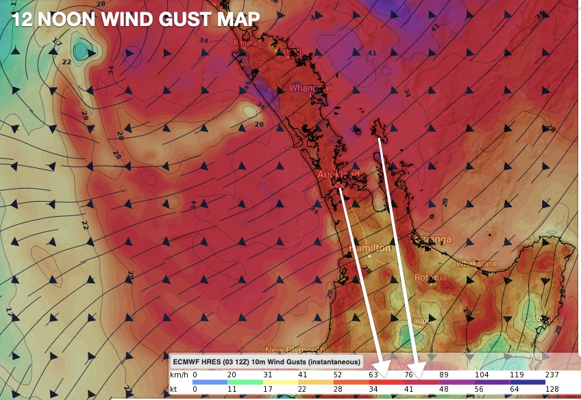
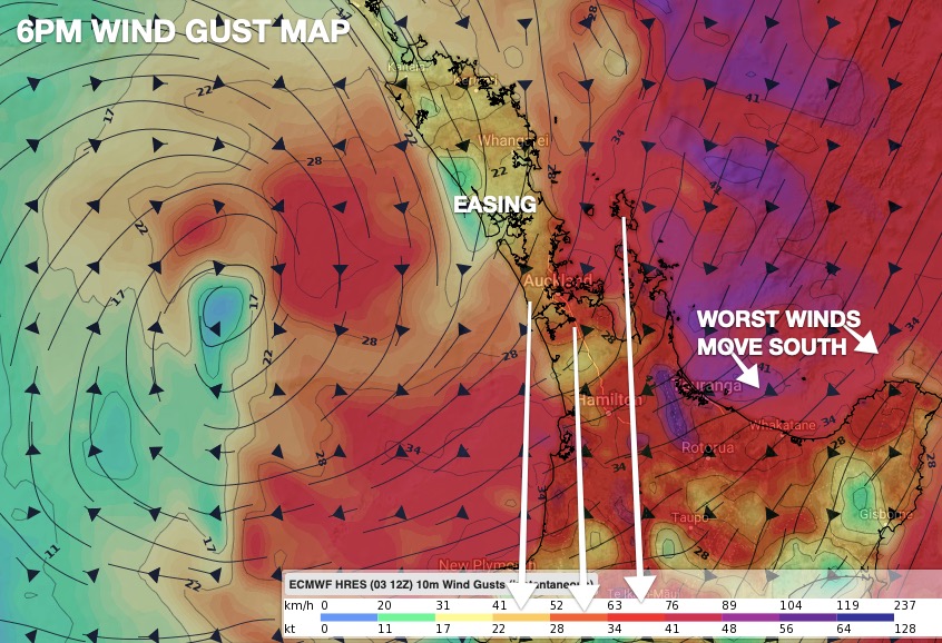
Here are the wind GUST maps, showing the main risk for potential. Remember, this winds are not sustained at these speed, this is the likely gusts.
Great Barrier Island, parts of Auckland (and the city) and Te Aroha in the eastern Waikato are all most exposed to the strongest gusts. Winds ease in Eastern Waikato/western Kaimai Ranges by midnight tonight at this stage. Gusts in parts of Te Aroha may exceed 120km/h for a time.

To drill down even deeper, view the wind graphs at www.RuralWeather.co.nz
Latest Video

Antarctic southerly for parts of NZ Fri & Sat
For the first time this year a southerly from off Antarctica is heading towards the South Island, followed by more…
Related Articles
Antarctic southerly for parts of NZ Fri & Sat
For the first time this year a southerly from off Antarctica is heading towards the South Island, followed by more…

Meteors – Your Eyewitness Reports!
WeatherWatch.co.nz receives meteor reports from all over New Zealand and the globe, 24/7/365. **CASUAL COMMENTS**If you’ve seen something in the…

Snow, rain showers & cold polar southerlies set to return
Friday will be a wintry day across NZ as the next cold front arrives, bringing snow to lower levels of…

