Sunday’s national forecast – West is warmest & driest, north east the wettest (+4 Maps)
20/06/2020 4:00pm

> From the WeatherWatch archives
High pressure continues to grow over the South Island while wetter, cloudier and milder airflows affect the North Island, especially the north east.
Today is also the Winter Solstice – at precisely 9:43am. Read more about that here.
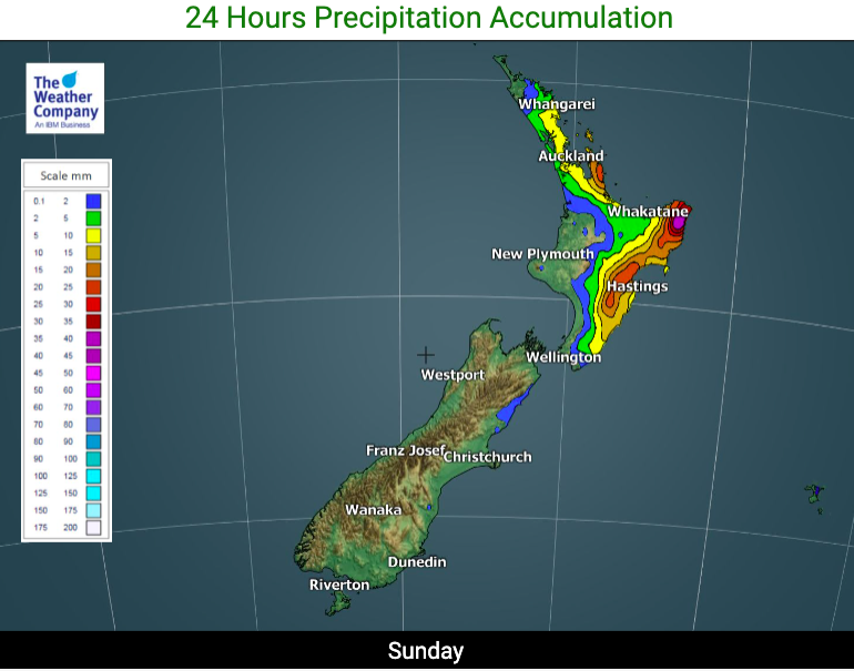
Showers will affect northern and eastern parts of the North Island, setting in as rain for a time in some areas (refer to your hourly forecast or graphs at www.RuralWeather for more local details and timing).
The rain in the east will be good at helping fix the soil moisture issues still continuing on in some areas. Basically NZ has two types of drought – soil moisture levels (which are now being repaired in most places) and long term underwater storage (aquifers) which still need many months more rain. The wet weather at the moment is helpful at fixing drought issues on the surface.
Meanwhile the airflows will see the eastern and southern South Island cool today while western areas of both islands learn warmer and sunnier.
Fiordland and the West Coast will have to be the place to be today! Sunny, dry and leaning warmer than average.


- WeatherWatch.co.nz & RuralWeather.co.nz
Latest Video

Antarctic southerly for parts of NZ Fri & Sat
For the first time this year a southerly from off Antarctica is heading towards the South Island, followed by more…
Related Articles
Antarctic southerly for parts of NZ Fri & Sat
For the first time this year a southerly from off Antarctica is heading towards the South Island, followed by more…

Meteors – Your Eyewitness Reports!
WeatherWatch.co.nz receives meteor reports from all over New Zealand and the globe, 24/7/365. **CASUAL COMMENTS**If you’ve seen something in the…

Snow, rain showers & cold polar southerlies set to return
Friday will be a wintry day across NZ as the next cold front arrives, bringing snow to lower levels of…

