Sunday’s national forecast – A westerly flow warms things up a little (+6 Maps)
17/04/2021 4:00pm

> From the WeatherWatch archives
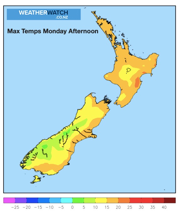
Westerly winds move in today and that will help lift temperatures up in the east during the afternoon.
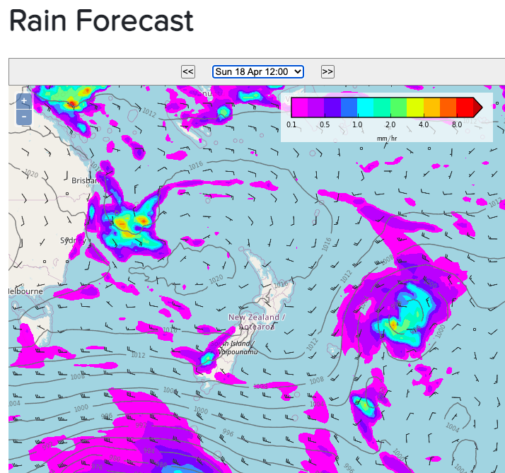
High pressure is centred over the Tasman Sea but a developing low lies east of Australia.
It’s a fairly dry day across New Zealand but some rain in Fiordland and showers (or lighter rain) further up into Westland. A shower or two possible in Southland today – otherwise dry and cloudy there.
Eastern areas will be warmest and sunniest while western areas of both islands look cloudiest.
It will be mild in northern NZ but cloud cover in the west may make it feel cooler.
As always, refer to your local HOURLY forecasts, powered by IBM. You’ll also find even more data (the most forecast data in NZ) at RuralWeather.co.nz.


Latest Video

More eastern rain, but a drier long weekend coming
Rain continues today along the eastern South Island and lower North Island, coming in from the east with heavy falls….
Related Articles
More eastern rain, but a drier long weekend coming
Rain continues today along the eastern South Island and lower North Island, coming in from the east with heavy falls….

More heavy rain, snow – but large dry areas, especially as we go into the long weekend
Heavy rain will continue for parts of Canterbury and Marlborough over the next day or two and it will gradually…

Large low brings rain, downpours & some snow – gets colder as the week progresses
Low pressure will cross the upper North Island in the days ahead and that set-up actually pushes more heavy rain…

