
> From the WeatherWatch archives
Today will be over 10 degrees above normal in some parts of New Zealand as a warm westerly with sub-tropical connections moves in and picks up.
The eastern South Island will be the most above average today with parts of Canterbury in the mid 20s, maybe even the late 20s (and if the mid to late 20s occurs it will mean some places are over 12 degrees above normal fore this date!).
However further south Southland in coastal areas has average temperatures for this time of year with rain clouds in the area.
Much of the North Island will also be warmer than normal although the very north is under the calming influence of high pressure – so a cool night and start to the day then a mild afternoon.
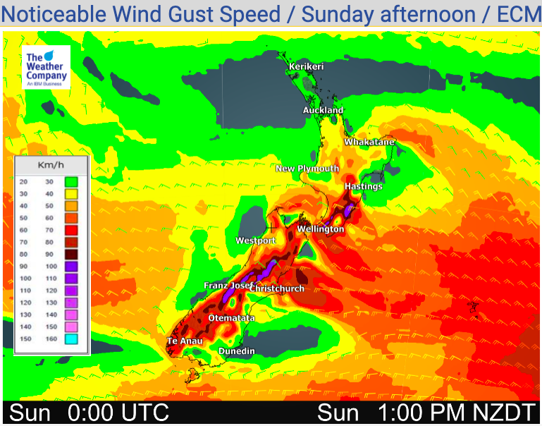
Many places are dry too – but some rain on the West Coast will be heavy towards Fiordland and Southland. Southland will have around 10 to 30mm of rain today.
For more details visit www.RuralWeather.co.nz


Latest Video

Cold weekend, frosts return with high pressure, then a low late next week
The subantarctic airflow spreads over NZ today/tonight and into Saturday, dropping temperatures nationwide. Snow flurries are possible today to lower…
Related Articles
Cold weekend, frosts return with high pressure, then a low late next week
The subantarctic airflow spreads over NZ today/tonight and into Saturday, dropping temperatures nationwide. Snow flurries are possible today to lower…

Wintry burst of weather: Snow, squally showers then sunshine & frosts
A polar change (another one!) arrives on Friday for the South Island and goes nationwide on Saturday, leaving NZ under…

Antarctic southerly for parts of NZ Fri & Sat
For the first time this year a southerly from off Antarctica is heading towards the South Island, followed by more…

