
> From the WeatherWatch archives
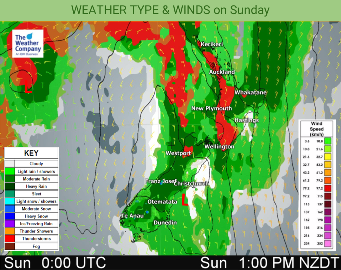
Sunday has a mix of drizzle patches, dry spells and downpours across the country along with some thunderstorms.
Rain will be broken up today with heavy set in falls but other surrounding areas drier with lighter spits.
Both islands have the same set up with the upper North Island and western side of the nation most exposed to heavy rain and driest areas in the east.
Thunderstorms are most likely in afternoon downpours in the upper North Island. Keep an eye on the MetService thunderstorm outlook for more details.
The map below shows the main risk areas (in red) for *potential* thunderstorms today. Check your local hourly forecast for more information.
It’s another warmer than average day across most of NZ except for Southland and Otago which see temperatures drop back to normal or even slightly below normal.
Highs: 11 to 25 (coolest in the south of the South Island)
– WeatherWatch.co.nz
Latest Video

Wintry burst of weather: Snow, squally showers then sunshine & frosts
A polar change (another one!) arrives on Friday for the South Island and goes nationwide on Saturday, leaving NZ under…
Related Articles
Wintry burst of weather: Snow, squally showers then sunshine & frosts
A polar change (another one!) arrives on Friday for the South Island and goes nationwide on Saturday, leaving NZ under…

Antarctic southerly for parts of NZ Fri & Sat
For the first time this year a southerly from off Antarctica is heading towards the South Island, followed by more…

Meteors – Your Eyewitness Reports!
WeatherWatch.co.nz receives meteor reports from all over New Zealand and the globe, 24/7/365. **CASUAL COMMENTS**If you’ve seen something in the…

