Sunday/Monday national forecast – Here comes a cold front (+8 Maps)
4/12/2021 3:00pm

> From the WeatherWatch archives
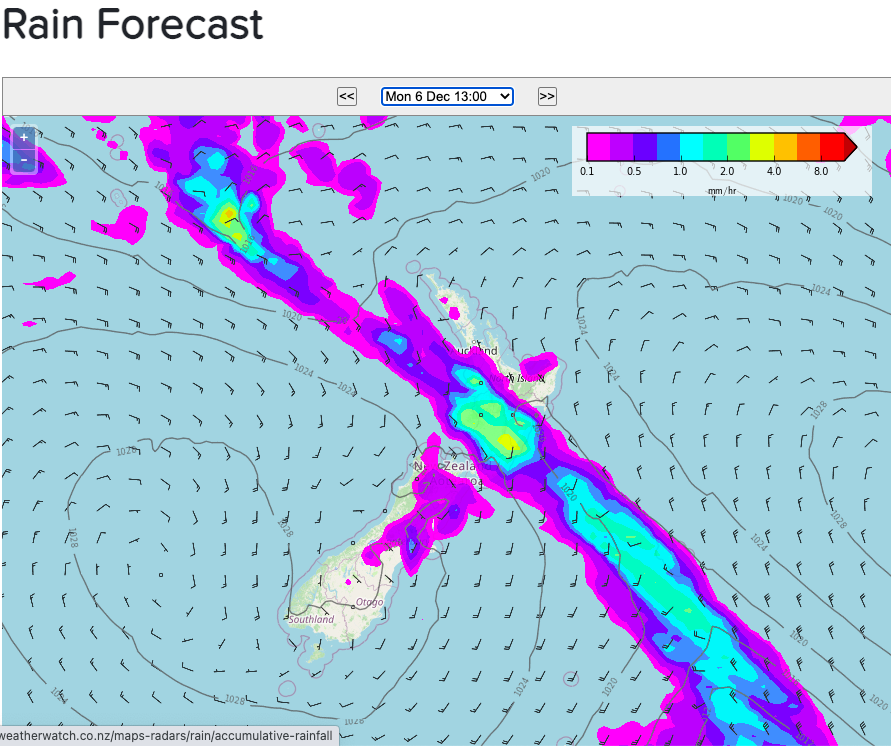
A cold front will move up the South Island today and the North Island on Monday, dropping temperatures below normal for some in the south and easing humidity elsewhere – for a brief time anyway.
The cold front will activate even heavier downpours up the West Coast and following two days of heavy rain this may lead to slips, flooding and road closures. The good news is high pressure is rolling in behind the front so rain will ease and then clear entirely on the West Coast.
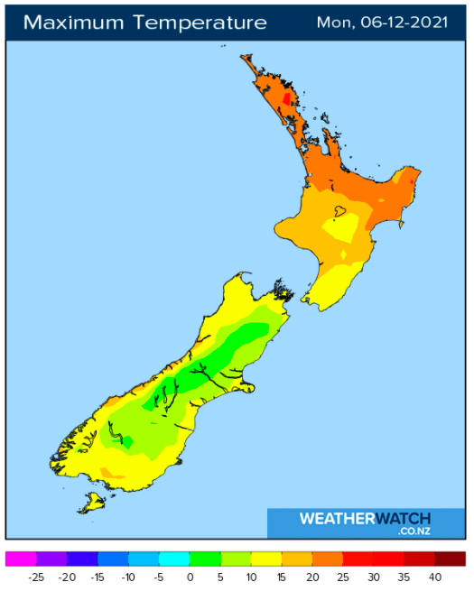
The high pressure zone – following that cold front – means temperatures will drop at night in the South Island tonight and tomorrow night. In fact, some places will be closer to zero degrees with frosts inland and on the ranges.
Some wet weather will move into dry eastern parts of the North Island (like Wairarapa).
Check your hyper-local WeatherWatch.co.nz forecast to drill down deeper for rainfall totals, or at RuralWeather.co.nz.


Latest Video

Wintry weather coming: Snow, rain, wind & sunshine
A cold front is moving into NZ from Friday to Sunday with low pressure developing west of NZ and then…
Related Articles
Wintry weather coming: Snow, rain, wind & sunshine
A cold front is moving into NZ from Friday to Sunday with low pressure developing west of NZ and then…

ClimateWatch: JULY outlook & what El Niño means for NZ
El Niño is officially here and still getting stronger in the months ahead, but it’s harder to notice its effects…

Low pressure heading to NZ this weekend & into next week
Many regions have settled weather at the moment with frosts as far north as Auckland this morning, but still some…

