Stormy weather to surge past NZ bringing gales and a wintry temperature drop (+4 Maps)
14/05/2019 11:14pm

> From the WeatherWatch archives
Hold on to your hats – we have Autumn gales and Winter temperatures in the forecast for some parts of New Zealand over the next several days. The windy weather will spread over a large portion of NZ but most exposed will be those in the south and in the usual exposed coastal areas elsewhere. The wind flow is mostly from the South West.
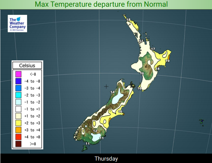
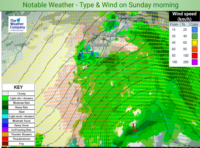
Thursday morning and again Sunday morning look especially windy with the lower South Island most exposed to both the windiest weather and the coldest air as a true southerly kicks in this weekend.
This southerly change will hack back temperatures with daytime highs in the single digits forecast on Sunday across a large portion of Southland and Otago at the warmest point of the day. In fact highs of just 7 to 9 degrees are currently forecast, including in Dunedin, Invercargill, Queenstown and Alexandra. Add on top of that strong to gale force winds for some areas – sustained at over gale force in some coastal areas in particular – with gusts over 100km/h it will feel wintry.
However the strong winds further north may actually keep temperatures around normal or even above normal for this time of the year.
The main surge of cold and wind looks to be on Sunday – then high pressure rolls in for early next week from the west.
Northern New Zealand is least affected by the windy, cold, change although Auckland may be a little blustery at times but nothing damaging or serious is currently forecast.


– WeatherWatch.co.nz
Latest Video

Wintry burst of weather: Snow, squally showers then sunshine & frosts
A polar change (another one!) arrives on Friday for the South Island and goes nationwide on Saturday, leaving NZ under…
Related Articles
Wintry burst of weather: Snow, squally showers then sunshine & frosts
A polar change (another one!) arrives on Friday for the South Island and goes nationwide on Saturday, leaving NZ under…

Antarctic southerly for parts of NZ Fri & Sat
For the first time this year a southerly from off Antarctica is heading towards the South Island, followed by more…

Meteors – Your Eyewitness Reports!
WeatherWatch.co.nz receives meteor reports from all over New Zealand and the globe, 24/7/365. **CASUAL COMMENTS**If you’ve seen something in the…

