Remnants of Cyclone Dovi about to make landfall in the North Island (+Maps & animation)
12/02/2022 6:32pm

> From the WeatherWatch archives
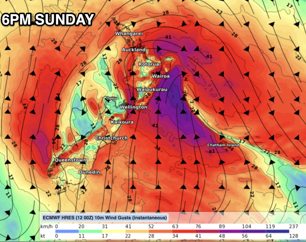
Updated 11:06am — Severe gales have been affecting parts of the top of the North Island overnight and it’s about to get windier as the centre of the storm that was once Severe Tropical Cyclone Dovi makes landfall here in New Zealand.
Auckland has wind gusts over 130km/h in the city and over 160 and 170km/h in more extreme exposed areas, according to Council data.
Winds in Auckland are likely peaking, damaging gusts are still possible until early to mid afternoon before tapering off.
A few changes this morning:
- Dovi’s remnants look to be tracking a few hours faster than originally forecast, meaning for some places in the north, the worst may be over by late afternoon.
- Dovi’s centre looks to track a little further south – this helps take some pressure off peak westerly wind speeds forecast for Auckland today (although damaging gusts are definitely still possible, the duration and peak of those winds may reduce a little and ease earlier today).
- The rain band ahead of Dovi has tracked further south, something WeatherWatch.co.nz highlighted on Friday was a possibility. This means rain continues to fall over Christchurch and now Westport too – although totals don’t look too intense today with only 10 to 20mm forecast.
- The centre of Dovi is likely to make landfall late morning or lunch time around North Taranaki / Waitomo area.
Damaging winds will move in across more of the upper North Island today and around Taranaki too potentially – then as the day progresses the worst of those winds shift to the eastern side of the North Island along with a gale southerly. That same southerly will finally bring a refreshing change to the muggy weather in the upper North Island.
Keep up to date with MetService warnings – they are LIVE updated on our website now, and in your hyper-local WeatherWatch forecasts (website only, we’re bringing to the app later this year).
To make sense of timing – please use the WIND, TEMP and RAIN graphs at RuralWeather.co.nz or the MAPS at WeatherWatch.co.nz.


Warnings and Watches as of 7:30am Sunday. Click the map for the LIVE VERSION
Latest Video

Westerly change this week, unsettled but large dry areas
Westerlies kick back in again this week which will bring a break to those in the east as far as…
Related Articles
Westerly change this week, unsettled but large dry areas
Westerlies kick back in again this week which will bring a break to those in the east as far as…

Matariki, the long weekend + the outlook for next week
Wet weather and cloud continues along the eastern side of the country with the heaviest rain now moving into northern…

More eastern rain, but a drier long weekend coming
Rain continues today along the eastern South Island and lower North Island, coming in from the east with heavy falls….

