RainWatch Tuesday: Useful showers continue for north of NI; mostly dry elsewhere
25/05/2020 7:00pm
> From the WeatherWatch archives
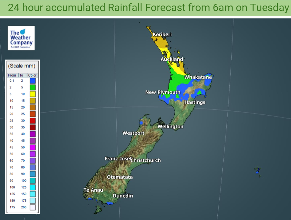
A ridge of high pressure pushing on to the South Island and the southern half of the North Island on Tuesday will bring dry weather there.

It’s a slightly different story for the top half of the North Island north of a line from about New Plymouth to Whakatane.
A weak trough of low pressure west of Waikato will encourage the development of showers across those more northern regions, and the showers could become more prolonged towards the end of the day as easterly winds pick up.
The good news is that by 6am tomorrow another 10 to 15mm of rain may have fallen across Northland and the Coromandel, with 5 to 10mm for Auckland and the Waikato.
A few light showers around the edge of the ridge of high pressure are also possible along the Southland coast and the Buller coast north of Karamea.

Further rain relief as the week goes on could bring another 20mm of so to parts of Auckland and Northland by Thursday morning.
For rainfall accumulation maps for 1, 2 and 3 days out please visit our new maps page: https://www.weatherwatch.co.nz/maps-radars/rain/accumulative-rainfall
By Guest Weather Analyst Paul Gorman – WeatherWatch.co.nz
Latest Video

Wintry weather coming: Snow, rain, wind & sunshine
A cold front is moving into NZ from Friday to Sunday with low pressure developing west of NZ and then…
Related Articles
Wintry weather coming: Snow, rain, wind & sunshine
A cold front is moving into NZ from Friday to Sunday with low pressure developing west of NZ and then…

ClimateWatch: JULY outlook & what El Niño means for NZ
El Niño is officially here and still getting stronger in the months ahead, but it’s harder to notice its effects…

Low pressure heading to NZ this weekend & into next week
Many regions have settled weather at the moment with frosts as far north as Auckland this morning, but still some…

