RainWatch: Dry for most, rain in Westland and Fiordland easing later
21/05/2020 7:00pm
> From the WeatherWatch archives
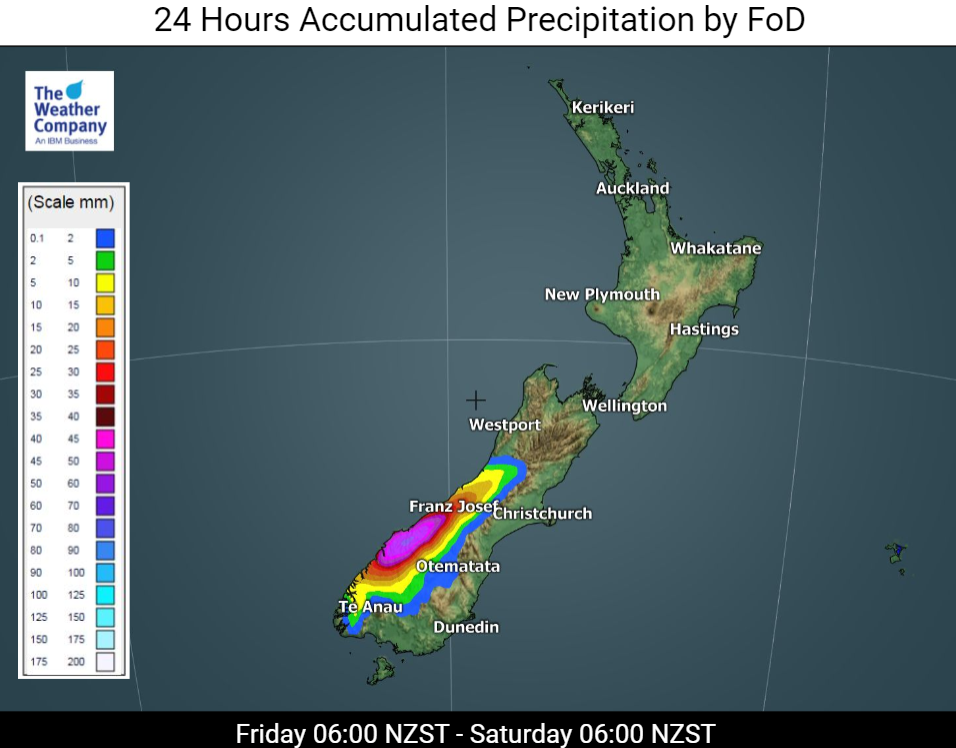
That sluggish cold front trying to make its way north up the South Island on Friday is fighting a losing battle and will gradually run out of puff tonight.
Some steady or heavy rain is likely in Fiordland and parts of South Westland south of the glaciers today, but further north on the Coast the falls will be lighter.

Rain there will mostly peter out by Saturday morning as that front weakens away to little more than some cloud sheets.
It’s possible that Southland and South Otago might also see a few blobs of rain this morning but overall the rest of the South Island will have a dry Friday.
As for the North Island? Well, the influence of that ridge of high pressure will ensure another dry and sunny day.
But, looking ahead, by the end of the weekend there are signs of something more in the way of rain starting to edge in to those very dry parts of the North Island.
For rainfall accumulation maps for 1, 2 and 3 days out please visit our new maps page: https://www.weatherwatch.co.nz/maps-radars/rain/accumulative-rainfall
By Guest Weather Analyst Paul Gorman – WeatherWatch.co.nz
Latest Video

Antarctic southerly for parts of NZ Fri & Sat
For the first time this year a southerly from off Antarctica is heading towards the South Island, followed by more…
Related Articles
Antarctic southerly for parts of NZ Fri & Sat
For the first time this year a southerly from off Antarctica is heading towards the South Island, followed by more…

Meteors – Your Eyewitness Reports!
WeatherWatch.co.nz receives meteor reports from all over New Zealand and the globe, 24/7/365. **CASUAL COMMENTS**If you’ve seen something in the…

Snow, rain showers & cold polar southerlies set to return
Friday will be a wintry day across NZ as the next cold front arrives, bringing snow to lower levels of…

