Rain & Snow maps for NZ (+Vic, Tas) over the coming days (+5 Maps)
16/09/2021 7:09pm

> From the WeatherWatch archives
New Zealand has more wet weather (and some snow) over the coming days as spring continues to do its thing – and some of that wet weather clips our neighbours in the south eastern corner of Australia too.
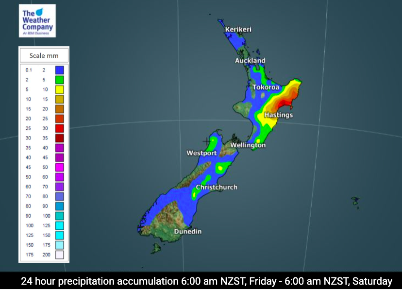
Much of the rain in the North Island today heads east and eases later, clearing on Saturday. Another 30 or 40mm is expected in the eastern North Island (northern Hawke’s Bay in particular).
As we go into Sunday and Monday wet weather from Tasmania and Victoria comes to New Zealand bringing heavy West Coast rain and showers for the western North Island. The lower half of the West Coast may have over 100mm early next week which will fall as heavy snow in the Southern Alps with 80 to 100cm on the summits.
Rain in NZ basically shifts from the north east (today) to the south west (by Monday).
To drill down deeper across New Zealand please visit www.RuralWeather.co.nz (NZ’s most accurate weather data website – powered by IBM).


Latest Video

More heavy rain, snow – but large dry areas, especially as we go into the long weekend
Heavy rain will continue for parts of Canterbury and Marlborough over the next day or two and it will gradually…
Related Articles
More heavy rain, snow – but large dry areas, especially as we go into the long weekend
Heavy rain will continue for parts of Canterbury and Marlborough over the next day or two and it will gradually…

Large low brings rain, downpours & some snow – gets colder as the week progresses
Low pressure will cross the upper North Island in the days ahead and that set-up actually pushes more heavy rain…

WeatherWatch App launches real-time local lightning tracker!
A bolt out of the blue! WeatherWatch has launched a live, real-time lightning tracker, enabling Kiwis to gain access to data provided by the…

