Rain, snow and gales – We have the latest details & maps to help you plan ahead (+9 Maps)
15/09/2021 7:01pm

> From the WeatherWatch archives
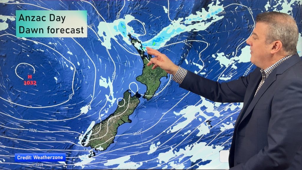
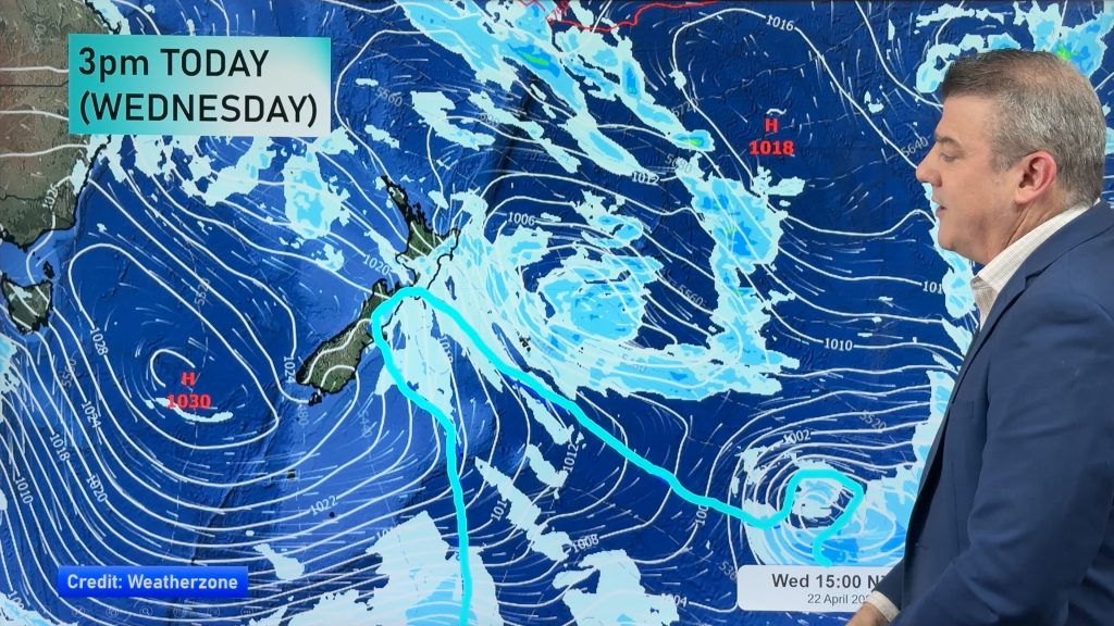
A large low pressure system is moving into northern NZ today and will track directly over Northland and Auckland this afternoon. The most widespread rain is pushing ahead of the low, so the eastern North Island will be most exposed as we go through today.
As of the time of this update (around 7am) the main front was leaving Auckland and tracking south eastwards into Bay of Plenty and Coromandel Peninsula.
However after the main front the lower air pressure centre itself will create instability and that will likely lead to afternoon downpours around Auckland and Northland – with the chance of an isolated thunderstorm. This means localised pockets may see double the rainfall today compared to those around them.
The low isn’t a storm but as it presses into high pressure further south it makes for gale force winds, with severe gales most likely though Cook Strait from the E to SE today.
FULL DETAILS:
- A huge low pressure and its associated frontal system have started to produce widespread rain and gusty winds across the North Island.
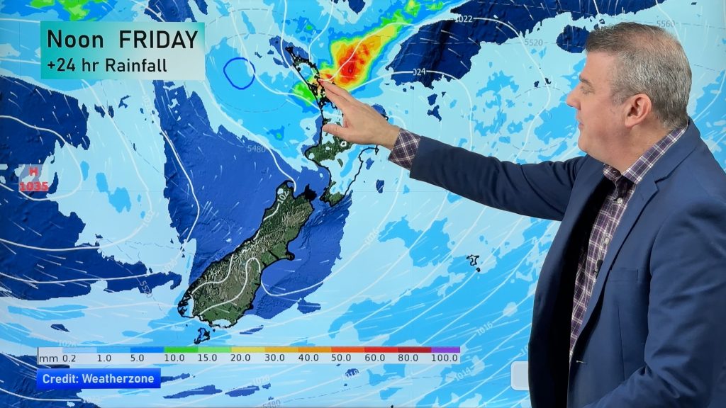
- In particular, heavy rain adding up to 100 mm is expected in the Hawke’s Bay region during next 36hours, a risk of localised flooding possible.
- Gisborne and Bay of Plenty region are also forecast 50 mm or more rain on Thursday.
- Snow may mix in high elevation areas above 1000 m in the North Island.
- Gusty winds in excess of 70 km/h are expected to peak in coastal parts of around Cook strait late Thursday through Friday morning. The gusty winds are predicted to remain until Friday afternoon.
- Scattered rain/snow are expected in some areas of eastern part of the South Island on Thursday but accumulation will be low. Snow level most likely above 200 or 300 metres but an isolated flurry may go lower.
- High pressure will dominate over the South Island from Friday bringing cold nights.
- Temperatures will run colder than normal in the eastern part of NZ for the next 2 days.
- Overnight temps are quite colder and near or below freezing over Southland and Otago region on Thursday through Friday. The colder trends will move into the North Island, but turning warmer from Sunday.
- A next round of severe rain activity will kick in over the South Island from Sunday, heavy rain/snow and gusty winds likely in mainly western coastal areas as the westerly winds return.


Comments
Before you add a new comment, take note this story was published on 15 Sep 2021.


Add new comment