NZ: Sunday update as an east coast storm strengthens further
15/02/2026 12:02am
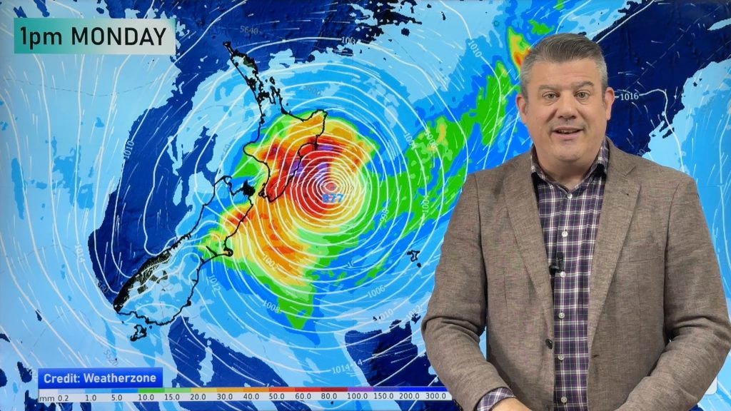
Stronger winds and heavy rain are in the forecast for Sunday PM and across Monday around eastern and central parts of the country as a storm deepens in air pressure off the North Island’s east coast.
Windy weather will fan out into a number of regions, while the worst winds will mostly be around the eastern North Island (south of East Cape), the lower half of the South Island, through the Cook Strait area and as far south as about Christchurch or Banks Peninsula.
We break down the rain maps and show which areas are most affected – and due to our mountains and ranges the rainflow will be broken up for some (hence the slight differences in how each agency forecasts the rain totals, as a slight difference in airflow can have big consequences for rainfall).
Following this low yet another subtropical storm will come in behind it around Wednesday and Thursday – while it does come close to East Cape it’s still forecast to remain offshore, but may directly affect the Chatham Islands.
By Friday of this coming week high pressure will be building west of the North Island with a showery south-west flow in most regions and mainly dry weather returning to those in the east.
Keep up to date with MetService warnings and the graphs in our free WeatherWatch App.
Comments
Latest Video

Low pressure heading to NZ this weekend & into next week
Many regions have settled weather at the moment with frosts as far north as Auckland this morning, but still some…
Related Articles
Low pressure heading to NZ this weekend & into next week
Many regions have settled weather at the moment with frosts as far north as Auckland this morning, but still some…

Colder nights/mornings, polar change coming Sun/Mon
The nights and mornings ahead will be colder in a number of regions – but an even colder change is…

Frosts, clearer skies coming – severe weather possible this weekend
High pressure lies south of NZ today and that placement encourages a colder south-east wind into the North Island bringing…


Mikayla on 15/02/2026 4:36am
How do you think people should prepare is they live along the Manawatu River in Palmerston North? Will these river levels be expected to breach in the heavy rain further up in the region?
WW Forecast Team on 16/02/2026 2:14am
Hi Mikayla, at this stage keep up to date with your local council, but not expecting any major problems with the Manawatu River, rain has already eased quite a bit in the region, although more rain in the ranges is certainly expected today.
Cheers,
– WW
Gillian on 15/02/2026 1:13am
Thank you for the update. Very informative as always