New Zealand: 3 day Rainfall Accumulation Map + InfoGraphics (x3)
11/06/2019 8:33pm

> From the WeatherWatch archives
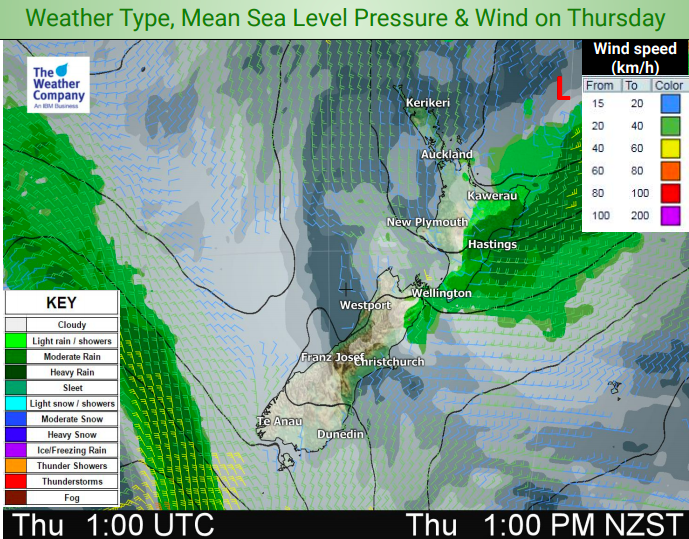
We have rain and showers coming to the two opposite corners of NZ – the western South Island and East Cape.
With a couple of cold fronts coming out of the Southern Ocean/southern Tasman Sea area places like Fiordland and further up around the Nelson Ranges should see the highest totals in the coming days.
Meanwhile a weak area of low pressure crossing the North Island today and lingering nearer to East Cape on Thursday will bump up rainfall totals there with 80 to 100mm possible in the ranges.


– WeatherWatch.co.nz
Latest Video

Wintry burst of weather: Snow, squally showers then sunshine & frosts
A polar change (another one!) arrives on Friday for the South Island and goes nationwide on Saturday, leaving NZ under…
Related Articles
Wintry burst of weather: Snow, squally showers then sunshine & frosts
A polar change (another one!) arrives on Friday for the South Island and goes nationwide on Saturday, leaving NZ under…

Antarctic southerly for parts of NZ Fri & Sat
For the first time this year a southerly from off Antarctica is heading towards the South Island, followed by more…

Meteors – Your Eyewitness Reports!
WeatherWatch.co.nz receives meteor reports from all over New Zealand and the globe, 24/7/365. **CASUAL COMMENTS**If you’ve seen something in the…

