NEW: ClimateWatch – November brings warmth, humidity, downpours & dry (+12 Maps +Video)
28/10/2020 10:11pm

> From the WeatherWatch archives
La Nina is developing but indicators suggest it may not be overly powerful. What does this mean for NZ as we head into summer?
Firstly, we’re noticing a few changes with our weather pattern from previous months.
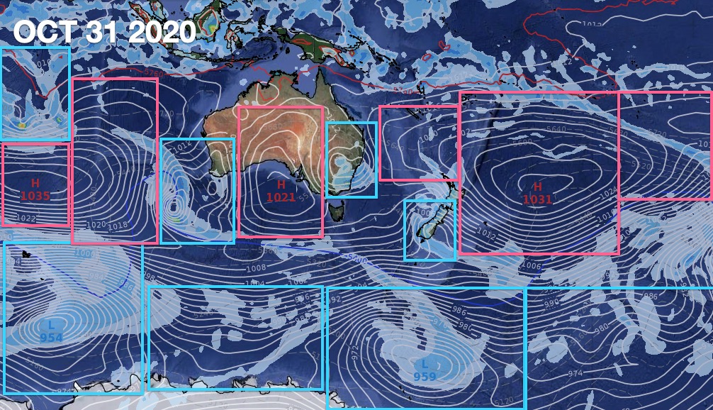
- More lows and rainmakers forming in eastern and south eastern Australia (bodes better for NZ as a fair chunk of our weather comes from there – this also highlights what a difference it is to a year ago when this part of Australia was in major drought and serious bush fires).
- Highs still large, but they are breaking up more with lows in between.
- High pressure belts drifting further south at times.
- More lows (mostly weak) forming in the sub-tropics just north of NZ.
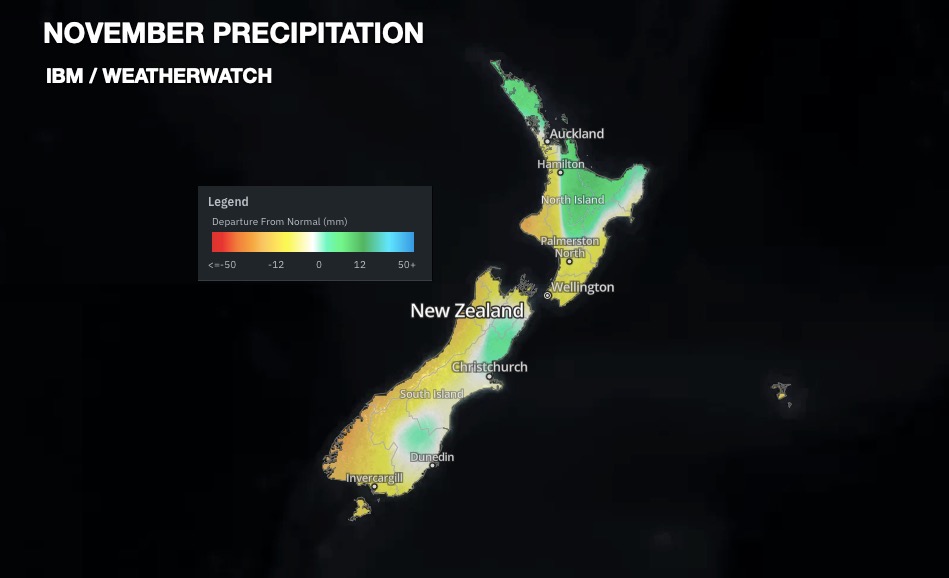
The airflows in November look to be quite mild compared to usual with plenty more mild sub-tropical air coming in. Generally speaking New Zealand may climb over 1 degree above normal for November.
This added warmth and humidity may be a positive for dry areas as it increases the risk of afternoon downpours (some with thunder). These downpours, if they form day after day, can create some great localised rainfall totals. The downside? Not everyone gets them.
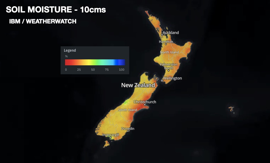
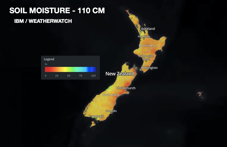
CURRENT SOIL CONDITIONS:
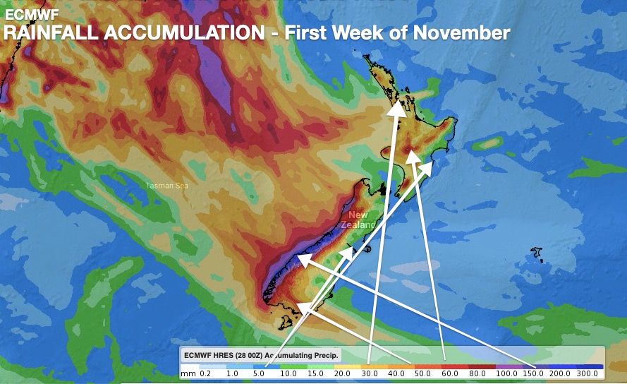
FUTURE RAINFALL:


NOVEMBER TEMPERATURE TRENDS:

All of NZ leans warmer than average by about 1 degree in November.
WHERE THE HIGHS AND LOWS WILL LIE OVER THE NEXT FEW WEEKS:

LA NINA


- RuralWeather.co.nz
Comments
Latest Video

Westerlies continue, sub-tropical for some
West to north-west winds blow through the South Island and lower North Island today bring heavy West Coast rain and…
Related Articles
Westerlies continue, sub-tropical for some
West to north-west winds blow through the South Island and lower North Island today bring heavy West Coast rain and…

Westerly change this week, unsettled but large dry areas
Westerlies kick back in again this week which will bring a break to those in the east as far as…

Matariki, the long weekend + the outlook for next week
Wet weather and cloud continues along the eastern side of the country with the heaviest rain now moving into northern…


Peter Thomas Langer on 29/10/2020 3:27am
aussie has had more wet seasons than us this is batty its more like el nino cold and wet to the south if it was la nina the places the niwa maps say that are dry would be very WET
josh on 29/10/2020 1:24am
this is really positive news dont you think. i hope a thunderstorm hits my part of auckland takanini (not far from hunua actually) 🙂 im really concern for cantubury though. if they get drier and drier they be in drought and in crisis.
Peter Thomas Langer on 29/10/2020 3:23am
this is getting very very silly the only season we have had rain in is winter 6 out of ten months have been way below average