Monday’s weather headlines (x3): Still wet in the east, Warm in the south, When is rain due for Southland?
27/03/2022 6:00pm

> From the WeatherWatch archives
Here’s what is making the weather headlines today.
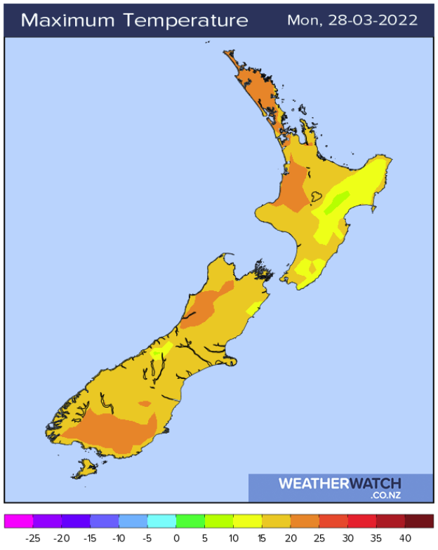
STILL WET IN THE EAST – NORTH ISLAND
A southerly quarter airflow continues to lie over the North Island today and continues to pump in showers or some rain, rain is more north of about Napier.
Finally later on Wednesday showers clear and the weather is looking dry for Thursday and Friday. In the weekend showers move back in.
LOWER SOUTH ISLAND NICE AND WARM THIS AFTERNOON
Temperatures are warm this afternoon about the lower South Island getting into the early twenties about coastal parts and into the mid twenties inland, there may be some low cloud or fog to start but that should clear away. Most western regions experience a pretty good day too with Reefton and Hamilton likely to get up to 24 or 25 degrees.
WHEN IS SOME RAIN DUE FOR SOUTHLAND?
Southland is the driest spots around the country at the moment and in need of rain, so is there any relief on the way? Later on Thursday and as we move into Friday morning a cold front pushes through bringing some rain, that looks to be the best shot over the next 10 days totaling 10 to 15mm, not a huge amount but we’ll take what we can get.
After that we do have a few showers moving through at times on Monday 4th through to Wednesday 6th April with westerly quarter winds but nothing overly substantial. A ml or two a day sort of thing.
Latest Video

NZ 7 day forecast: Showers, temp changes and heavy West Coast rain
NZ has a fairly messy forecast over the next 7 days, but the main feature will be heavy rain on…
Related Articles
NZ 7 day forecast: Showers, temp changes and heavy West Coast rain
NZ has a fairly messy forecast over the next 7 days, but the main feature will be heavy rain on…

Cold fronts continue, wind & rain for some Fri/Sat
Wet weather is moving over the North Island today, while the South Island has drier skies – ahead of another…

Cold fronts vs high pressure
A cold front is moving up NZ today and into Tuesday, but will fall apart as it heads north and…

