Monday’s weather headlines (x3): More unstable showers, Sunny in the south, Cold front tomorrow
20/02/2022 6:00pm

> From the WeatherWatch archives
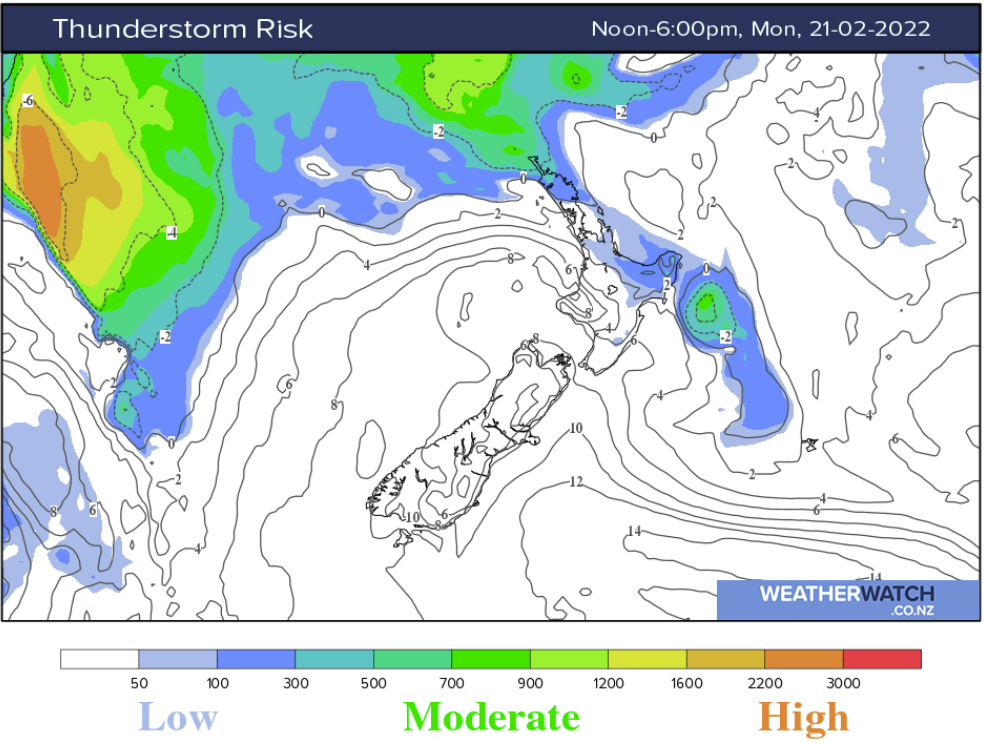
MORE HEAVY SHOWERS IN THE NORTHEAST
Conditions about northeastern parts of the North Island become a little unstable this afternoon, this will lead to isolated showers and some may become heavy with thunderstorms. This is for inland Hawkes Bay / East Cape and through inland Bay Of Plenty, the highest risk is for the ranges of East Cape.

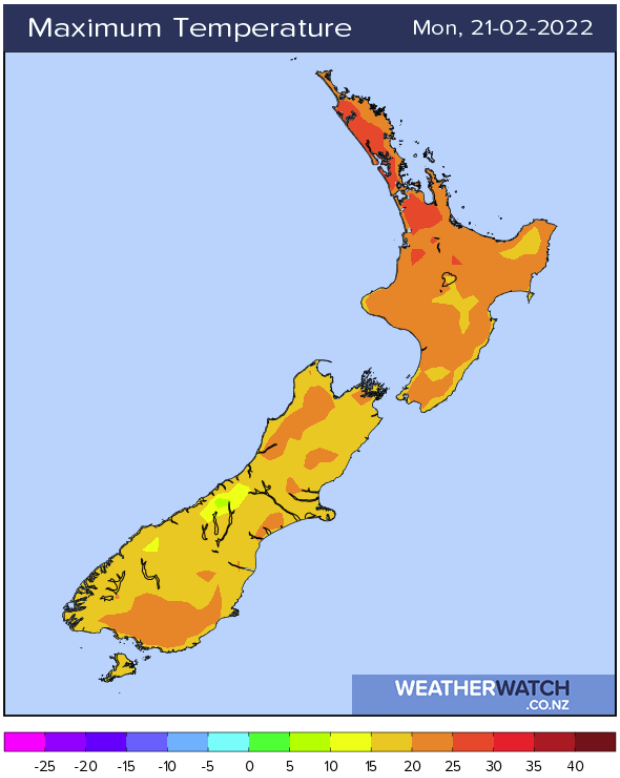
SOUTH ISLAND HAS DRY / SUNNY WEATHER TODAY
A great day on the way for the South Island today, all regions will be dry and warm. Inland areas will be the warmest with light winds expected. East to northeasterly winds in the east especially across the Canterbury Plains will freshen up this afternoon bringing a slightly cooler feel. Mackenzie Country through to Central Otago sees highs in the late twenties today.
COLD FRONT MOVING ONTO THE LOWER SOUTH ISLAND TOMORROW
A cold front is due to move onto the lower South Island tomorrow morning and with it comes some rain, the further north the front moves it slows down and weakens so Canterbury for example will likely only get showers for a time in the evening / overnight. Nelson and Marlborough stay dry all day, perhaps Marlborough might briefly see a shower on Wednesday first thing in the morning. Buller may actually see an isolated shower on Wednesday afternoon.
Wellington up through to Gisborne gets a few showers on Wednesday as southwesterly winds spread northwards during the day.

Latest Video

Slow go for northern low & southern cold
For the next few days low pressure will crawl over the upper North Island, driving in rain as far south…
Related Articles
Slow go for northern low & southern cold
For the next few days low pressure will crawl over the upper North Island, driving in rain as far south…

Slow moving low to track over northern NZ
A low pressure zone will slowly cross the North Island over the coming days, bringing hit and miss pockets of…

NI low pressure, SI polar change
Low pressure will move over the upper North Island this week, bringing hit and miss pockets of heavier rain into…

