Monday’s Weather Headlines (x3): High moves away, Rain update for the North and South Islands
30/01/2022 6:00pm

> From the WeatherWatch archives
HIGH’s ON THE WAY OUT
The high bringing us settled weather over the last few days is moving out to our east early this week, meanwhile a low drops into the Tasman Sea from up north with heavy rain due for the West Coast from Wednesday and rain may get into northern Northland for a time.


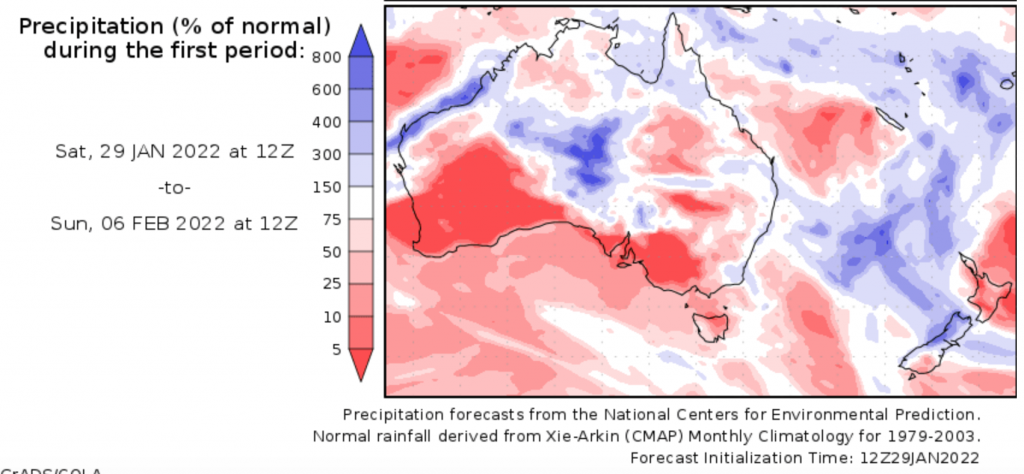
NO SILVER BULLET REGARDING RAIN FOR THE NORTH ISLAND
From Wednesday we do see showers for the western North Island and some rain for northern Northland for a time, but beyond that it’s still looking largely dry for the North Island unfortunately for the foreseeable future (next two weeks at least). You can see this in the map below, the blue colour represents wetter weather basically while the red is dry.
WEST COAST HAS DECENT RAIN ON THE WAY
While the North Island misses out on decent rain the West Coast of the South Island has plenty on the way. Check out the figures for Reefton coming up be clicking here.
Latest Video

Slow go for northern low & southern cold
For the next few days low pressure will crawl over the upper North Island, driving in rain as far south…
Related Articles
Slow go for northern low & southern cold
For the next few days low pressure will crawl over the upper North Island, driving in rain as far south…

Slow moving low to track over northern NZ
A low pressure zone will slowly cross the North Island over the coming days, bringing hit and miss pockets of…

NI low pressure, SI polar change
Low pressure will move over the upper North Island this week, bringing hit and miss pockets of heavier rain into…

