Monday’s national forecast – Front moves into the west (+10 maps)
28/02/2021 3:00pm

> From the WeatherWatch archives
A northeasterly airflow lies over New Zealand today with a front pushing in from the Tasman Sea onto the West Coast.
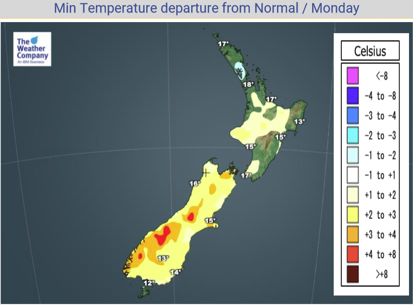
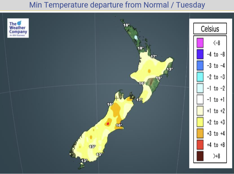
North Island
Areas of cloud and occasional sun, the odd shower in the northeast from Northland through to East Cape then isolated showers about some inland areas further south this afternoon. Showers may be heavy then easing this evening. Some rain possible about Northland and Auckland late afternoon / evening with a chance of thunder.
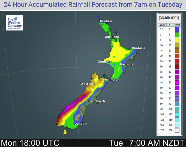
South Island
Showers for the West Coast, rain for Buller / Tasman and Nelson at times. In the east conditions are drier, expect plenty of cloud though especially this morning. About Southland and Otago isolated showers develop this afternoon especially inland, some may be heavy with a risk of thunder then clearing tonight.
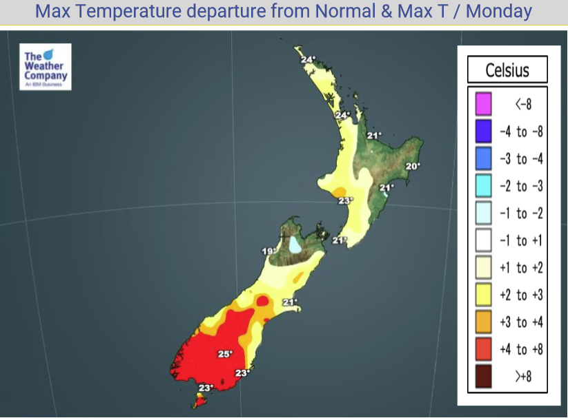
Temperatures in the early to mid twenties for most today, perhaps late twenties for Central Otago.
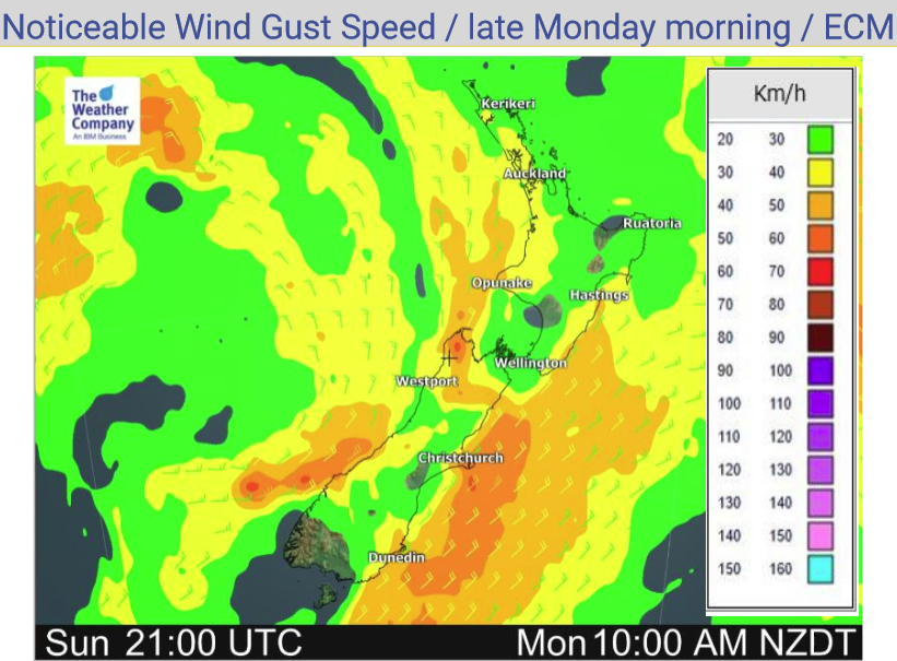
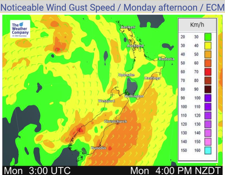
Northeasterly winds for most, breezy at times about some coastal parts of the South Island.
Please refer to your local, hourly, 10 day forecast for more details.


Latest Video

Snow, rain showers & cold polar southerlies set to return
Friday will be a wintry day across NZ as the next cold front arrives, bringing snow to lower levels of…
Related Articles
Snow, rain showers & cold polar southerlies set to return
Friday will be a wintry day across NZ as the next cold front arrives, bringing snow to lower levels of…

Frosts, late week rain & another cold weekend coming
High pressure will cross NZ over the next few days meaning more cold nights/mornings with frosts, but a nor’wester will…

NZ: Cold & windy, then calm & frosty
Downpours, some squally with the chance of thunderstorms and even small tornadoes are possible for parts of NZ over Friday…

