Monday’s national forecast – Front incoming (+12 maps)
1/08/2021 4:00pm
> From the WeatherWatch archives
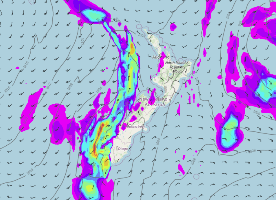
A ridge of high pressure brings settled weather to New Zealand this morning, from afternoon however a front and low combination has the South Island in its sights with some wet weather on the way starting in the west.
Please refer to your local, hourly, 10 day forecast for more details.
North Island
A few areas of morning low cloud or fog, sunny spells otherwise. Cloud starts to start thicken in the west this morning and perhaps bring a light shower or two as light winds tend westerly. In the east there is some morning cloud with a coastal shower or two then clearing and becoming mostly sunny with southwesterlies dying out. This evening widespread showers move in out west as a front pushes in, winds change gusty southwest around midnight. Scattered rain in the east overnight.
Note: Expect strong to gale force southwesterlies for the upper / western North Island on Tuesday.
South Island
The West Coast has a bit of cloud, perhaps a light shower or two. Morning cloud in the east breaks but then expect thickening high cloud with northeasterlies. Rain moves into Fiordland around midday then pushing northwards up the West Coast during the afternoon, also getting into Southland then eventually Otago. Rain spreads elsewhere during the evening with the airflow changing to the southwest by midnight. Snow lowers to 600m overnight in the ranges. Skies clear up for Fiordland overnight.


Latest Video

Snow, rain showers & cold polar southerlies set to return
Friday will be a wintry day across NZ as the next cold front arrives, bringing snow to lower levels of…
Related Articles
Snow, rain showers & cold polar southerlies set to return
Friday will be a wintry day across NZ as the next cold front arrives, bringing snow to lower levels of…

Frosts, late week rain & another cold weekend coming
High pressure will cross NZ over the next few days meaning more cold nights/mornings with frosts, but a nor’wester will…

NZ: Cold & windy, then calm & frosty
Downpours, some squally with the chance of thunderstorms and even small tornadoes are possible for parts of NZ over Friday…

