Low pressure covers North Island but centred over Northland for much of today (+9 Maps)
15/10/2019 12:49am

> From the WeatherWatch archives
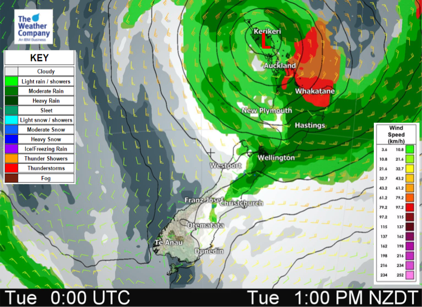
It was a wet and windy night in the upper North Island now wind and rain is moving across the rest of the island and some of the upper South Island as the low very slowly moves in.
In fact as of 8am the centre of the low was directly over Northland, spinning in a clockwise fashion and still bringing E to NE winds into Auckland – but they will be lighter today than overnight. Still, gales are possible around Great Barrier Island. The rain clouds in the north are also more broken up around the centre with sunny spells possible later today.
Heavy rain slides down the eastern side of the North Island with drizzly patches moving into the north eastern South Island today.
The centre of the low will remain over Northland for much of the day with the low still developing – but tonight it drifts over Great Barrier Island and then slowly crosses over East Cape on Wednesday with a clearance developing for most regions.
By Thursday the low has gone.


 ABOVE – PAST 24 HOURS RAINFALL
BELOW – NEXT 24 HOURS RAINFALL (7A TUE – 7A WED)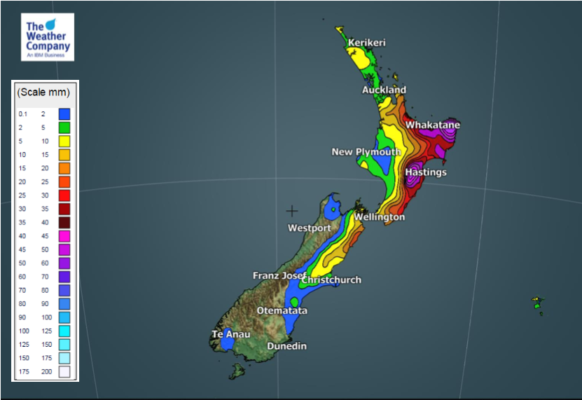


– WeatherWatch.co.nz
Latest Video

Cold weekend, frosts return with high pressure, then a low late next week
The subantarctic airflow spreads over NZ today/tonight and into Saturday, dropping temperatures nationwide. Snow flurries are possible today to lower…
Related Articles
Cold weekend, frosts return with high pressure, then a low late next week
The subantarctic airflow spreads over NZ today/tonight and into Saturday, dropping temperatures nationwide. Snow flurries are possible today to lower…

Wintry burst of weather: Snow, squally showers then sunshine & frosts
A polar change (another one!) arrives on Friday for the South Island and goes nationwide on Saturday, leaving NZ under…

Antarctic southerly for parts of NZ Fri & Sat
For the first time this year a southerly from off Antarctica is heading towards the South Island, followed by more…

