Large low today, hit & miss downpours / thunderstorms + your weekend outlook
2/12/2025 10:39pm
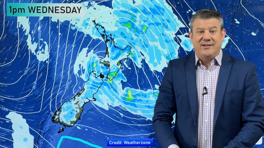
A large low pressure system is bringing unstable weather conditions to most of the North Island today, resulting in downpours, thunderstorms (some severe) but also a mixture of dry and drizzly/lighter areas.
Low pressure systems like this are well known for “breaking” your local forecast, this is due to the instability the lower air pressure creates – and then our mountains and ranges play a role too. This means very heavy downpours can occur in one spot, while only a short distance away it may be sunny and dry. Understanding this will lead you to watching the rain radar and understanding where these main areas of heavy rain and thunderstorms are tracking across the day, to make sense of it all.
Otherwise, put simply, there is some wind and rain (over the North Island and upper South Island today/tonight) with it clearing the country on Thursday, gone by the end of tomorrow.
The weekend has west to north-west winds returning, which means many places will be warmer/hotter and drier going into Sunday. We have your NZ forecast through to Tuesday next week.
Comments
Latest Video

Wintry blast coming this weekend, everyone will feel the temperature drop
A significant cold change is coming in this weekend, starting as early as Friday for the lower South Island and…
Related Articles
Wintry blast coming this weekend, everyone will feel the temperature drop
A significant cold change is coming in this weekend, starting as early as Friday for the lower South Island and…

Tracking the showers & a potential wintry blast late next week
NZ is on the edge of high pressure with anticyclones moving through at times over the next several days bringing…

Some polar airflows but more high pressure to affect NZ’s weather
Showers are in the forecast over the next several days, we track where and when they occur – but there…


Wayne on 3/12/2025 7:09am
Thanks again for an honest weather report