Is this NZ’s shortest cold snap of 2019? Just 12 little hours…
22/08/2019 7:28pm

> From the WeatherWatch archives
NZ has had some short lived cold snaps this winter but the one coming in today and tonight is truly the shortest. While both Friday and Saturday will see a large portion of the country warmer than average a nationwide southerly change tonight will reverse that trend making for a colder than average night in many places.
But…by noon Saturday it’s ending and the warmer than average afternoon kicks in as the colder southerly change quicky gets pushed east of NZ by a stronger westerly flow.
It’s yet another sign we’re entering a spring pattern where cold snaps becoming shorter lived and westerly winds dominate.
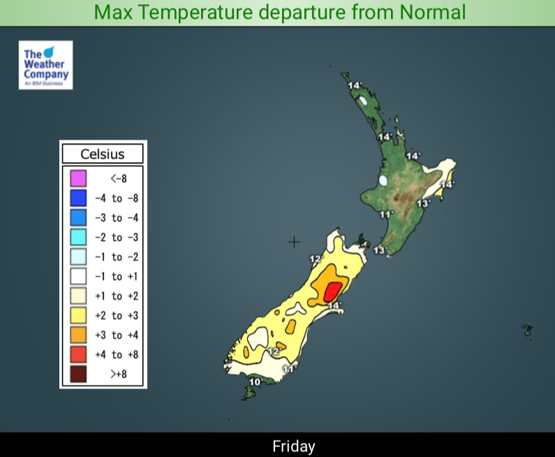
Next week the westerlies dominate mostly from the W to SW direction which means some in the south may have colder air at times while those further north have a mild week ahead, especially those in the north east. Places like the Bay of Islands look fairly dry next week with highs in the late teens, possibly even 20 degrees. Dunedin on the other hand may have some days with single digit highs.
NOON TODAY:
MIDNIGHT TONIGHT:
NOON SATURDAY: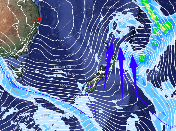


– WeatherWatch.co.nz
Latest Video

Wintry burst of weather: Snow, squally showers then sunshine & frosts
A polar change (another one!) arrives on Friday for the South Island and goes nationwide on Saturday, leaving NZ under…
Related Articles
Wintry burst of weather: Snow, squally showers then sunshine & frosts
A polar change (another one!) arrives on Friday for the South Island and goes nationwide on Saturday, leaving NZ under…

Antarctic southerly for parts of NZ Fri & Sat
For the first time this year a southerly from off Antarctica is heading towards the South Island, followed by more…

Meteors – Your Eyewitness Reports!
WeatherWatch.co.nz receives meteor reports from all over New Zealand and the globe, 24/7/365. **CASUAL COMMENTS**If you’ve seen something in the…

