Heatwave likely for inland South Island as big dry moves in to North Island (+10 Maps)
22/11/2019 8:54pm

> From the WeatherWatch archives
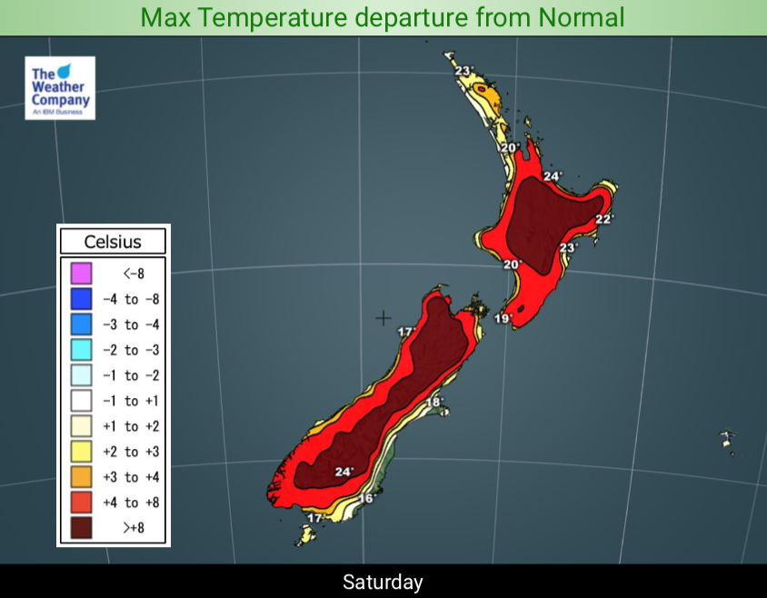
Heatwave criteria is being challenged through the South Island’s interior as the North Island enters a significant dry spell.
Daytime temperatures are forecast by WeatherWatch.co.nz to exceed five degrees for five days or more through inland parts of the South Island from today onwards. In fact inland areas will be over 10 degrees above normal in the days ahead through both islands as sub-tropical and Australian airflows drift over New Zealand with large high pressure parked in the Tasman Sea.
The hotter weather shifts into the North Island this weekend but varying wind flows means the North may not reach heatwave criteria.
But as we’ve been forecasting all week the North Island is now entering a very dry phase with little to no rain forecast for the rest of November in most regions. However there may be some afternoon downpours that bubble up around the North Island, mostly through central areas or around the ranges. Isolated inland thunderstorms may also be possible. So, very locally some people may get a decent drop of rain but for the most part it’s looking much drier than normal and warmer than usual across the North Island and eastern side of the South Island.


UPCOMING 7 DAY RAINFALL OUTLOOK COMPARED TO NORMAL: Red = Drier than average, White = Normal rainfall, Blue = Wetter than usual for this time of year.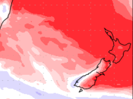

THUNDERSTORM/DOWNPOUR OUTLOOKS FOR THE NORTH ISLAND
SATURDAY PM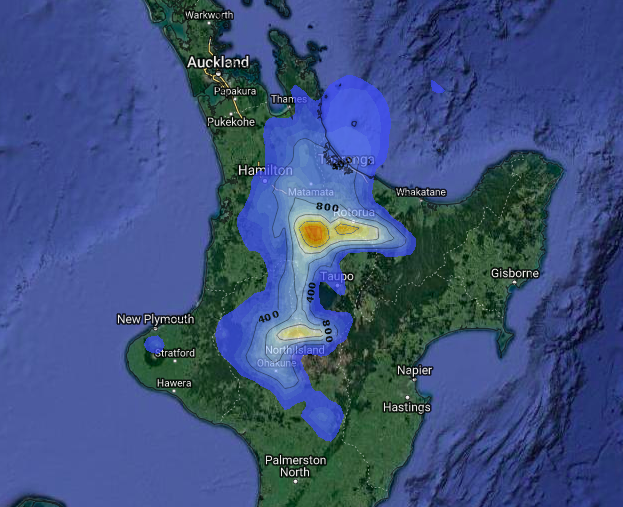
SUNDAY PM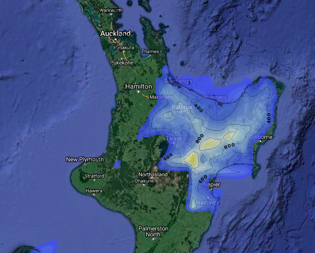
MONDAY PM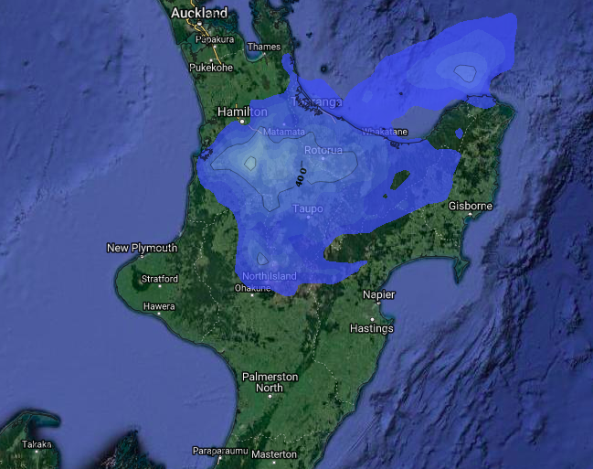
– WeatherWatch.co.nz
– RuralWeather.co.nz for more information
Latest Video

Antarctic southerly for parts of NZ Fri & Sat
For the first time this year a southerly from off Antarctica is heading towards the South Island, followed by more…
Related Articles
Antarctic southerly for parts of NZ Fri & Sat
For the first time this year a southerly from off Antarctica is heading towards the South Island, followed by more…

Meteors – Your Eyewitness Reports!
WeatherWatch.co.nz receives meteor reports from all over New Zealand and the globe, 24/7/365. **CASUAL COMMENTS**If you’ve seen something in the…

Snow, rain showers & cold polar southerlies set to return
Friday will be a wintry day across NZ as the next cold front arrives, bringing snow to lower levels of…

