Frosty for many in the south tonight, temperatures dip nationwide for most (+11 Maps)
17/09/2021 2:10am

> From the WeatherWatch archives
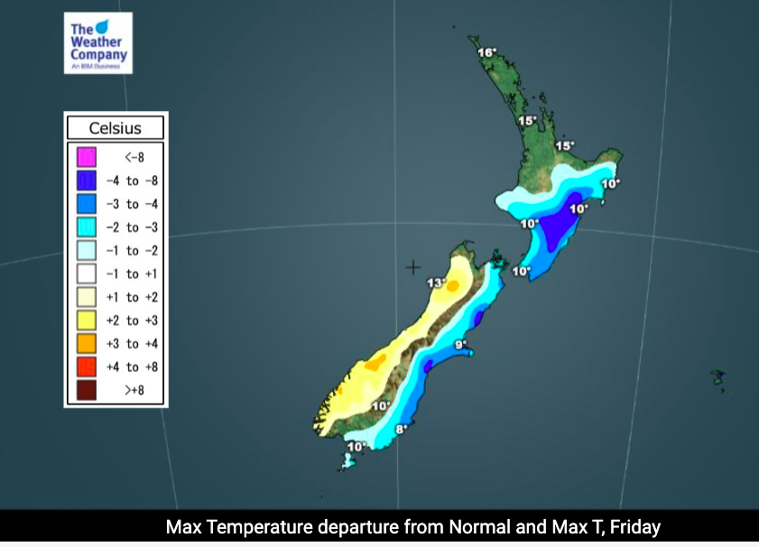
Colder air is moving into the North Island today while high pressure is locking in the cold further south – bringing frosts tonight.
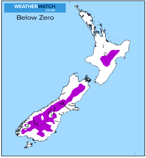
Frosts will be widespread across the South Island with heaviest frosts in Northern Southland, Central Otago and inland Canterbury. Most places dip to +3 to -3C tonight across a large portion of the South Island.
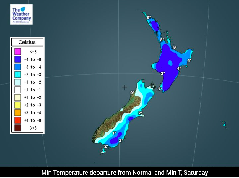
The North Island has a colder night on Saturday night as cloud from the nearby low finally clears away. Frosts are more limited in both islands on Saturday night as a milder westerly change returns to southern NZ.
However despite the cold night tonight in the South Island, today the West Coast leans warmer than average and on Saturday much of the inland South Island learns warmer than average (coastal areas normal) while the eastern North Island remains below normal for this time of year.


Latest Video

Rain & showers this weekend, colder change next week
Some places will warm up over the next day or so as a nor’wester out of Australia moves across NZ,…
Related Articles
Rain & showers this weekend, colder change next week
Some places will warm up over the next day or so as a nor’wester out of Australia moves across NZ,…

Temperature changes for some regions ahead of heavy West Coast rain
A nor-wester is about to kick in and it’s coming from out of Australia, boosting temperatures in some regions going…

NZ 7 day forecast: Showers, temp changes and heavy West Coast rain
NZ has a fairly messy forecast over the next 7 days, but the main feature will be heavy rain on…

