Friday’s weather headlines (x3): A nice day in the west and south, Cold front then showers
24/02/2022 6:00pm
> From the WeatherWatch archives
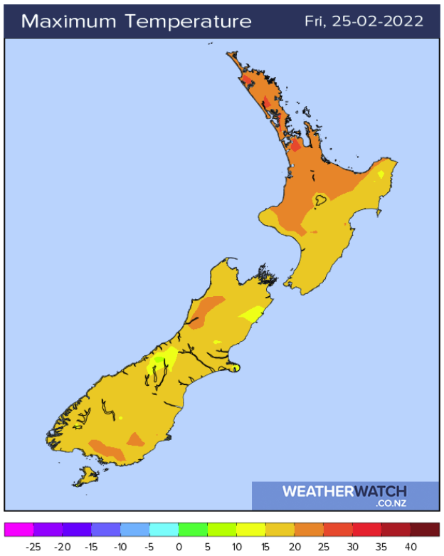
WEST IS BEST
The weather out west is best today in regards to both Islands, temperatures this afternoon for the Waikato will reach into the mid twenties. The West Coast is a bit cooler but still reasonable with highs in the early twenties, although inland Buller does reach 25, it’s more the fact that winds will be light and skies clear this afternoon. Inland Southland and Central Otago will likely get into the mid twenties with light winds and mostly sunny conditions.
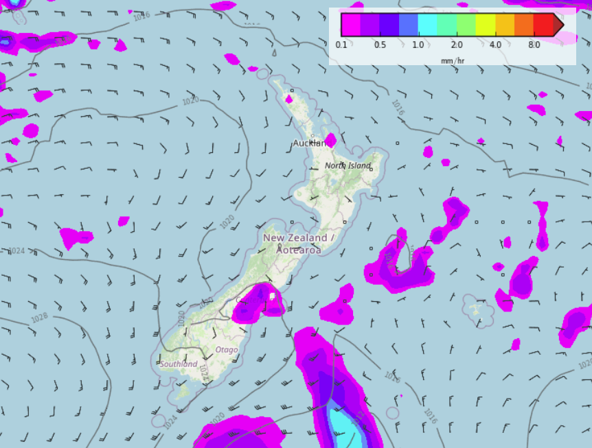
COLD FRONT TO MOVE IN ON SATURDAY
A cold front moves onto the lower South Island overnight or perhaps more towards dawn on Saturday and reaches into Canterbury in the afternoon bringing a drop in temperatures and showers. Conditions clear up fairly promptly once the front moves through though, the lower South Island should break to sun in the afternoon while showers for Canterbury ease evening and clear overnight. The front reaches the lower and eastern North Island in the evening with showers spreading in there.
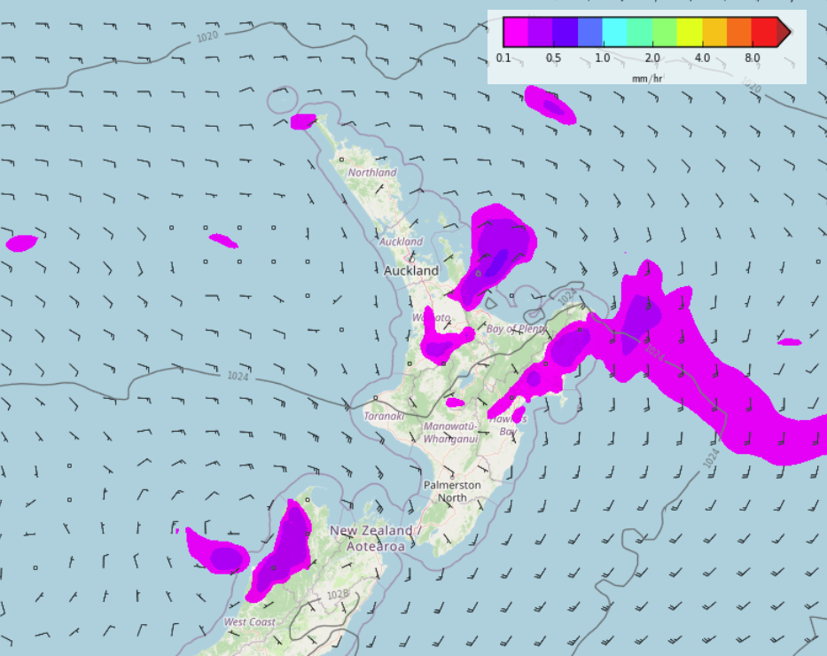
UPPER AND EASTERN NORTH ISLAND GETS SHOWERS SUNDAY / MONDAY
The eastern North Island gets showers on Sunday (mainly dry for Wairarapa though) then as day wears along a few showers move in for the likes of Waikato, Coromandel and perhaps Auckland moving in from the east.
Monday sees a few showers Waikato northwards with east to northeasterly winds, perhaps a shower or two may persist for Hawkes Bay and Gisborne with a southerly airflow there.

Latest Video

Slow go for northern low & southern cold
For the next few days low pressure will crawl over the upper North Island, driving in rain as far south…
Related Articles
Slow go for northern low & southern cold
For the next few days low pressure will crawl over the upper North Island, driving in rain as far south…

Slow moving low to track over northern NZ
A low pressure zone will slowly cross the North Island over the coming days, bringing hit and miss pockets of…

NI low pressure, SI polar change
Low pressure will move over the upper North Island this week, bringing hit and miss pockets of heavier rain into…

