Friday’s national forecast – Brrrr, here comes a late spring southerly! (+4 maps)
26/11/2020 3:00pm

> From the WeatherWatch archives
A light frost is possible overnight tonight in parts of the South Island’s interior as a colder than usual southerly for this time of the year heads up the nation.
Today will have below average temperatures in Southland, Otago and the southern half of Canterbury.
By tonight the overnight lows will be below normal in across about 80% of New Zealand.
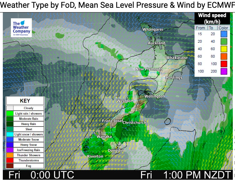
The southerly change is short lived but will bring some wet weather into dry parts of Canterbury, Otago.
Northern NZ has a drier day.
Winds will be picking up again from the south west.
Here are the regional forecasts for Friday…
Northland, Auckland, Waikato & Bay Of Plenty
West to SW winds, a little brisk later through Auckland and some coastal areas. A dry mild day though with just a few passing clouds in the west, sunniest in the east.
Highs: 20-25
Western North Island (including Central North Island)
A little windy with westerlies and passing clouds. Mostly dry but might be a shower.
Highs: 18 – 20
Eastern North Island
A mostly sunny warm day, hottest around inland Gisborne and northern Hawke’s Bay. Westerlies for most, stronger in Wairarapa.
Highs: 20-27
Wellington
A mix of sun and cloud with mild northerlies. However a stronger southerly arrives end of the day bringing showers and a temperature drop.
High: 19 – 21
Marlborough & Nelson
Mainly Sunny with west to south west breezes.
Highs: 21 – 23
Canterbury
South to south west winds developing for many with showers moving up the region, clearing later. Showers may turn to a period of rain in North Canterbury later in the day.
Highs: 14-22
West Coast
Some showers but fairly dry with west to south west winds. Dry later as high pressure moves in.
Highs: 16 – 18
Southland & Otago
Showers will cooler west to south west winds. By night time winds ease as high pressure grows, bringing overnight lows into Saturday morning close to freezing for some.
Highs: 12-17
THE MAPS:


Latest Video

Antarctic southerly for parts of NZ Fri & Sat
For the first time this year a southerly from off Antarctica is heading towards the South Island, followed by more…
Related Articles
Antarctic southerly for parts of NZ Fri & Sat
For the first time this year a southerly from off Antarctica is heading towards the South Island, followed by more…

Meteors – Your Eyewitness Reports!
WeatherWatch.co.nz receives meteor reports from all over New Zealand and the globe, 24/7/365. **CASUAL COMMENTS**If you’ve seen something in the…

Snow, rain showers & cold polar southerlies set to return
Friday will be a wintry day across NZ as the next cold front arrives, bringing snow to lower levels of…

