Expected Rainfall for the rest of February (+6 Maps)
21/02/2021 8:57pm
> From the WeatherWatch archives
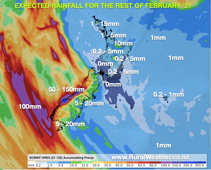
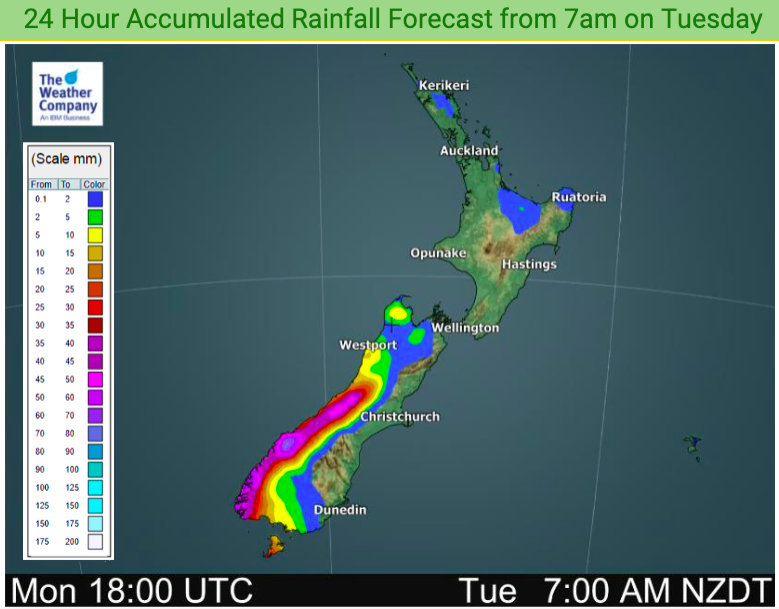
High pressure dominates out to the east of NZ while a small but potent low from the Tasman Sea moves into the West Coast this week and falls apart.
A new easterly flow in the North Island will bring in a few showers to northern NZ.
Most of the North Island is dry for the rest of February, but a shower is likely here and there – especially eastern areas to the north as that easterly wind flow kicks in.
There may be a few locations that get a heavier afternoon downpour but these do look very isolated. Overall the North Island again leans drier than average this week.
The South Island is mostly dry in the north and east but rain on the West Coast from a low in the Tasman Sea that arrives later on Tuesday does have the potential to drop 100 to 150mm in this area and this may spillover a little in eastern and southern regions.
However the eastern half of the South Island also looks to lean drier than average this week for this time of year.
Check your LOCAL HOURLY forecasts to see expected rainfall totals where you are!


Latest Video

NI low pressure, SI polar change
Low pressure will move over the upper North Island this week, bringing hit and miss pockets of heavier rain into…
Related Articles
NI low pressure, SI polar change
Low pressure will move over the upper North Island this week, bringing hit and miss pockets of heavier rain into…

Rain & showers this weekend, colder change next week
Some places will warm up over the next day or so as a nor’wester out of Australia moves across NZ,…

Temperature changes for some regions ahead of heavy West Coast rain
A nor-wester is about to kick in and it’s coming from out of Australia, boosting temperatures in some regions going…

